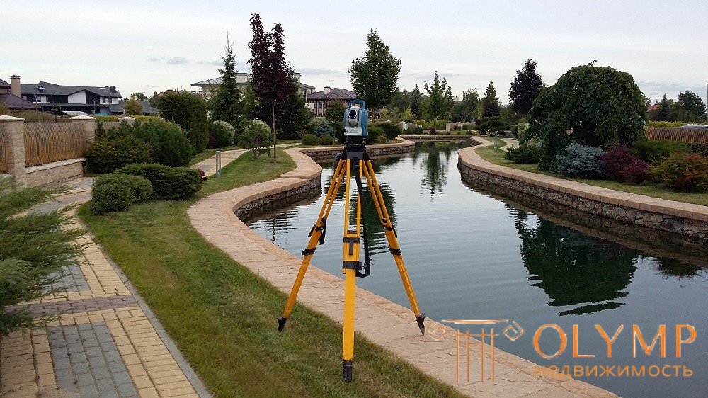
To large-scale include shooting at a scale of 1: 5000, 1: 2000, 1: 1000, 1: 500.
When choosing a scale, the surveys are guided by the purpose of the survey, the size of the territory to be removed, the complexity of the relief and the saturation of the territory with elements of the situation (built-up).
The plans show all the elements of the situation, the size of which allows you to depict them on the scale of the plan or standard conventional signs. The terrain is depicted on the plans as contours, and auxiliary contours in combination with conventional signs and marks, rounded to 1 cm.
The main method of shooting on a scale of 1: 5000, 1: 2000 at present is a method based on the use of aerial photography materials. Mensulta and tacheometric surveys are mainly used for shooting small areas and on a scale of 1: 1000, 1: 500, when the use of aerial photography is economically unjustified. For these purposes, photo-tolit shooting can also be used. Aerial topographic surveys are used for all scales and perform stereotopographic or combined methods.
Consider the features of each of the methods.
In the case of a stereotopographic method, an erotation of the shooting, the drawing on the plan of the situation elements and the drawing of the relief are performed in office conditions on stereo devices. With the combined method — based on the field binding of aerial photographs, a photoplane is created; relief drawing on the photoplan is produced in field conditions using a scale frame. When creating plans of scale 1: 5000, 1: 2000, preference is given to the stereotopographic method, since it turns out to be more economical than the combined method, except when the stereoscopic method does not provide the required accuracy of the relief drawing (flat-flat terrain).
Surveying on a scale of 1: 1000 and 1: 500 on undeveloped areas, as a rule, is carried out using a frame, tacheometer, or square leveling method.
The men and women of the shooting are taken from the points of the reference geodetic network and the points of the shooting substantiation, as well as from the points of the pacemaker and tacheometric moves, in compliance with distances to picket points, lengths and discrepancies of moves, and other requirements specified by the relevant instructions.
In the conditions of flat terrain, in undeveloped areas, for more accurate vertical imaging on characteristic landforms, they lay technical leveling moves with breakdown and leveling of diameters.
In built-up areas, surveys on a scale of 1: 1000 and 1: 500 are carried out in a combined way — the main buildings and engineering networks are removed by an analytical method, and secondary contours and temporary buildings are taken using menzules. In the analytical method, surveys are carried out from points and lines of the shooting justification, as well as from polygonometry points. When shooting, the polar method, the method of perpendiculars, linear and angular serifs are used. Responsible, multi-storey (supporting) buildings coordinate, i.e. the position of their angles is determined analytically.
In addition to these works, a detailed measurement of buildings is performed, showing all protruding and protruding elements and measuring the distances between neighboring buildings. The results of measurements are recorded in a special summary journal.
The high-altitude survey is conducted with the support of the network of points of leveling courses created earlier.
When shooting open flat areas with a uniform situation, the square method is widely used. A grid of squares of 40 x 40 m or 20 x 20 m, and sometimes smaller ones, is broken on the removed area; the elements of the situation are taken by measuring with a tape measure from the nearest vertices of the squares, the heights are determined by leveling on the squares. Most often, the method of squares is used when shooting the areas allocated for the construction of airports, on the agricultural areas allocated for irrigation.
Game: Perform tasks and rest cool.8 people play!
Play gameThe creation of large-scale engineering plans with the use of materials and erophtic has a certain specificity as compared with general photographic surveys, especially expressed in the conditions of heavily built-up areas of industrial enterprises, populated places and cities. In these territories there are always a large number of various kinds of important objects: above-ground, above-ground and underground structures (communications), which, as a rule, are not recognized in the photographs and their display requires a large amount of field interpretation work using instrumental methods of attachment.
At such sites, it is advisable to carry out marking of all geodetic points before the aerial photography survey so that they can be easily identified in the photographs and used in the processing and interpretation of aerial photographs.
Game: Perform tasks and rest cool.8 people play!
Play game
Что бы оставить комментарий войдите
Комментарии (0)