“Geodesy” is a word of Greek origin, its name is derived from two Greek words “gê” - “geo” - “earth” and “daizo” - “daijo” - “share” , which means “Earth division” in translation. Such a literal definition of geodesy says only that it is one of the oldest Earth sciences. There was this science with the beginning of agriculture. In the process of historical development, the content of each science is constantly changing, and therefore the gap between the name of science and its content is inevitable. For example, "geometry" is literally defined as "land measurement . " However, in our time, measurements on Earth are not subject to geometry. Geodesy is engaged in this problem - the science of measurements on the Earth’s surface and in near-Earth space, as well as on calculations and graphical constructions carried out for :
Thus, the subject of geodesy is a geometric study of the physical surface of the Earth and the changes occurring with it.
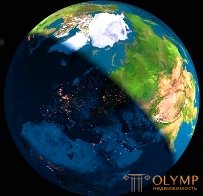
The surface of the Earth (Fig. 1) is characterized by a variety of forms. It contains all sorts of objects of natural and artificial origin, the geometric modeling of which is extremely important for a person.
|
|
|
| ||
Fig. 1. Physical surface of the Earth
Design, construction and operation of engineering structures, planning, landscaping and improvement of populated areas, exploration and mining of mineral resources, agricultural and forestry production, ensuring the defense capacity of states - in all these and many other areas of human activity have to solve problems of a geometric nature related to the Earth’s surface . Their solution is based on the method of measuring various quantities. This method is an integral part of geodesy.
In geodesy, the achievements of astronomy, physics, mathematics, mechanics, electronics, geomorphology, and other sciences are widely used.
Astronomy, which studies the Earth as one of the celestial bodies that influence the motion of other celestial bodies, provides geodesy with the necessary initial data.
For the measurement of the earth’s surface, various instruments and instruments are used, in the creation of which the scientific achievements of physics, chemistry, mechanics, optics, electronics and other sciences are applied.
When measuring various quantities, it is almost impossible to get their true value. In this connection, it is necessary to determine their most probable value, i.e. closest to the true. To this end, geodesy applies mathematical processing of measurement results, which uses the achievements of higher mathematics, computing, mathematical statistics, probability theory, error theory, information theory.
For registration of measurement results and calculations in geodesy, the method of graphical presentation of data is used. To use it, knowledge of topographic drawing techniques is necessary. With this method, drawings are drawn up that are the product of geodesic works and are characterized by complex symbolism, high accuracy and high quality workmanship.
Geodesy also has a close relationship with geography and geology, especially geomorphology.
Geography studies the natural conditions surrounding human society, the location of production and the conditions of its development. Knowledge of geography provides the correct interpretation of the elements of the landscape, which are: relief, natural cover of the earth's surface (vegetation, soil, sea, lake, river, etc.) and human performance (settlements, roads, communications, enterprises, etc.). d.)
Geology studies the structure, mineral composition and development of the Earth. Geomorphology - the relief of the earth's surface and the laws of its change.
Application of photographs in geodesy requires knowledge of photography.
Currently, in connection with the widespread use of digital and electronic mapping, geographic information and global navigation systems, remote sensing of the Earth by aerospace tools, advances in computer science, automation and electronics are becoming increasingly important for geodesy.
In the course of its development, geodesy was divided into a number of scientific disciplines:
higher geodesy;
topography;
the engineering geodesy;
cartography;
photogrammetry;
radio geodesy;
space geodesy;
geodetic instrumentation.
Higher geodesy studies the shape and size of the Earth, the movement of its crust and determines:
type and size of the Earth (as a planet);
external gravitational field of the Earth (the value and direction of gravity in terrestrial space and on the surface);
the relative position of geodetic points that are significantly distant from each other;
the accuracy of the image points on the plane in the projection with regard to the distortion due to the curvature of the earth's surface.
Topography studies the methods of imaging areas of the earth's surface using materials from survey work and creating topographic maps and plans on their basis.
Engineering geodesy studies the methods and methods of geodetic support in the development of projects, construction and operation of various facilities, as well as in the development and protection of natural resources.
Space geodesy considers the theory and methods of solving scientific and practical problems on the earth's surface according to observations of celestial bodies (Moon, Sun, AES) and according to observations of the Earth from space. Space geodesy includes global navigation systems, which are the basis of the currently used coordinate systems, and multi-purpose space remote sensing systems used to monitor the surface of the Earth.
The subject of study of cartography are methods and methods of displaying the surface of the Earth and the processes occurring on it in the form of various figurative-iconic models, including digital and electronic maps.
Photogrammetry solves the problem of measuring by aerial photographs and satellite images for various purposes: creating maps and plans, designing and building structures, measuring and determining the area of buildings, forests, etc.
Что бы оставить комментарий войдите
Комментарии (0)