Definition: residential area - a zone for housing, community centers and recreation areas of the population, non-production environment of the population.
In small and medium-sized cities, the residential area usually makes up half of the entire territory of the city, with about half of the village itself being occupied by housing, and the rest is used for sections of public institutions of urban importance, urban highways and green spaces. In large cities, this ratio changes due to the greater development of the transport network and a reduction in the share of residential areas.
The living environment is organized at all levels: in the district planning, the choice of sites for housing construction is carried out, the master plan addresses issues of the complex organization of the residential zone of a city or rural settlement, architectural and planning proposals for the development of residential complexes are developed in detailed planning and development projects , types of residential and public buildings.
For a preliminary determination of the need for a residential area, aggregates are taken depending on the number of floors, they range from 10 to 7 hectares per thousand people.
Residential areas in cities need to be divided into areas of no more than 250 hectares of highways or stripes of greenery.
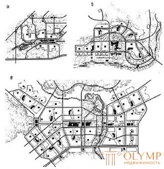
The planning structure of a residential area provides for the rational organization and mutual placement of all its elements. The planning organization of a residential area depends on the size of the city, the climatic conditions, the growth rate of the city, etc. (Fig. 82).

Fig. 82. The planning structure of the residential zone of new cities of various sizes: a small city of 30 thousand inhabitants; b - average city per 100 thousand; in - a large city of 350 thousand.
The general principle of the formation of a residential area is to ensure maximum convenience of the population in the implementation of its social and cultural and everyday needs, rational use of resources and urban land.
When organizing residential areas solve the following main tasks:
1. Organization of the main functional processes (life, rest, service);
2. Achievement of transport and pedestrian accessibility;
3. Creating an environment that is favorable for sanitary conditions; 4. Creating an aesthetically complete habitat.
The main link in the structure of a residential area is residential formations formed within inter-trunk areas based on the functional and spatial unification of groups of residential buildings based on a joint service system (neighborhoods, neighborhoods).
(step principle of organization of public services)
one.  Institutions of occasional use (theaters, zoo, hippodrome, circus, city administration, etc.) are located in the center or suburb (Fig. 83).
2. Institutions of periodic use (shopping centers, sports complexes, cinemas, etc.) are located in public centers of planning districts (Fig. 83).
3. Everyday establishments (kindergartens, schools, catering establishments, shops, pharmacies, etc.) are located in the immediate vicinity of
from housing (Fig. 83). Fig. 83
Definition: the principle of microdivision is based on the integration of residential entities around the institutions of everyday services, the formation of a sustainable community of residents ("neighborhood"), the creation of a safe and comfortable living environment.
The principle of microzonation has been widely used in urban planning practice since the mid-twentieth century. At present, a significant part of the residential areas of large cities is represented by micro-districts (Fig. 84-87).

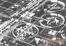
Fig. 84. The project of the village Krasnoobsk.
The residential area of the village consists of three microdistricts arranged around Fig. 85. The group of housing estates in p.
Public Center Krasnoobsk, NSO, view from space

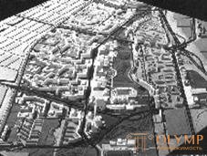
Fig. 87. RAP residential area
Kropotkinsky, NGP, 1973, arch.
Fig. 86. Microdistrict number 5, V. Blinkov, A. Bondarenko, V. Galyamov, B.
Novosibirsk, view from space Zherebyatiev, G. Tumanik
Transit traffic is excluded in the microdistrict, mainly pedestrian environment is formed.
A brief history of the term "neighborhood".
At the end of the XIX century. an unacceptable sanitary and hygienic (ecological) situation has developed in large cities of industrialized countries. Most of the population lived in residential areas with a very high density of housing; housing was not aired or insulated. With the growth of population and consolidation of buildings, living conditions have deteriorated more and more (Fig. 88-90).

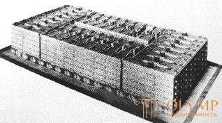
Fig. 89. Project proposal for building residential Fig. 88. Buildings in Berlin, a quarter in New York, beginning of the twentieth century. end of the XIX century.

Fig. 90. Modern examples of "continuous" construction of residential areas.
At the beginning of the XX century. there is an active search for new ways and forms of development of the city (“garden city”), including the search for new techniques and principles for organizing residential space at different levels from a residential house (“home-machine for housing”) to a residential area, city, settlement systems.
As an alternative to the perimeter building of quarters with deaf well-yards, architects offered a lower-level construction method (Fig. 91), and later - the principle of free planning (Fig. 92-94).
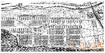
Fig. 91. Lower building, Frankfurt am Main, architects E. May, G. Bem, V. Schwagenshaydt, Mautner, 1929
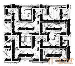
Fig. 92. Buildings in a residential area of Barcelona, arch. L.Kh. Sert 1933-35
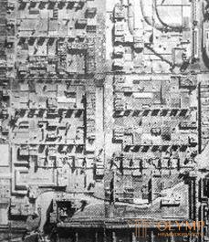
Fig. 93. Residential area, arch. F.L. Wright
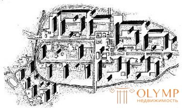
Fig. 94. Residential district of the city of Mo, arche Le Corbusier, 1955-1960.
The beginning of the widespread application of the principle of "micro-zoning" in the USSR occurred in the 1960s. This period is associated with the beginning of large-scale construction and the application of industrial methods of housing construction. The first series of typical housing practically did not leave room for creative search in the formation of urban space and for many years predetermined the image of residential areas of many Soviet cities and cities of the world (Fig. 96, 97).

Fig. 96. Barcelona, Spain Figure. 97. Development typical for many cities of the USSR
Subsequently, the number of floors of typical sections was increased, angular and turning sections were developed, which somewhat expanded and enriched the professional tools of the architect.
Despite the limited possibilities, architects in the USSR and abroad continued their creative search. Means of expressiveness were: the use of multi-storey buildings, plastic construction lines, plastic land and the use of relief, super-graphics, etc. (Fig. 98-102).

Fig. 98. Residential area Fig. 99. District in Fig. 100. Microdistrict in
"Curtilier" in Bubigny Orebro (Sweden), arch. Orebro (Sweden), arch.
(France), arch. Aylaud Ekholt and White Bakstrom and Rainius, 1950
 Fig. 101. Neighborhood
Lazdinai, Vilnius 1970s, arch. V. Čekanauskas, V. Rice. 102. Residential District Nanterre, arch. E. Ayo, thin F. Rieti,
Bredikis, V. Balchyunas, G. Paris
Valyushkis
The planning decision of a neighborhood depends on a whole complex of factors:
the situation in the city, climatic conditions, relief and its orientation, socio-economic and demographic situation, etc.
The neighborhood in the functional planning and compositional solution should be considered as an integral part of the overall plan of the spatial organization of a residential area or the entire city. In the microdistrict, it is also customary to single out several stages or levels of the organization of development (Fig. 103).

Fig. 103. The step principle of the organization of residential development: a - a group of houses; b - residential area; in - microdistrict
The main goal of the planning organization of the neighborhood is to create a comfortable and safe living environment. From this follows a number of tasks: the formation of an expressive image, the creation of a full-fledged service system, the breeding of pedestrian and transport traffic, the protection of courtyard spaces from noise, the landscaping of the territory, etc. (Fig. 104).
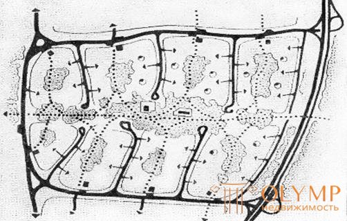
Fig. 104. The theoretical scheme of the planning organization of the microdistrict
In the neighborhoods provide a system of pedestrian paths, consisting of the main pedestrian roads and approaches to buildings. This system should connect residential groups with the shortest distances to public transport stops, public centers, car storage places and other objects of mass violence. The main pedestrian roads are trying to isolate from the streets and driveways (Fig. 105).

Residential area "Le Mirai" in Toulouse, arch. Residential area "Le Mirai", a network of streets Kandilis, Woods, Zhozik, 1961 pedestrian traffic
Fig. 105. An example of breeding pedestrian and car flows in the neighborhood
The transport service system plays an important role in the organic connection of the main functional areas of the microdistrict and consists of an extensive network of passages and entrances to homes, schools, kindergartens, and community centers. Elements of the street network in the neighborhood are divided into categories: residential streets (along the outer contour of the red lines), driveways, pedestrian roads, walking and cycling paths.
The driveway system is designed in such a way as to exclude transit traffic. In order to restrict freight traffic, garages and shops are located along the periphery of a microdistrict near city streets. The system of internal passages can be designed for dead-end, ring, loop and mixed circuits (Fig. 106).

Fig. 106. Variants of the organization of transport passages in the microdistrict
Population density is the main indicator of the intensity of development of a residential area. This indicator is regulated by SNiP 2.07.01-89 *, "... the population density, as a rule, should not exceed 450 people / ha."
The recommended population density for areas of varying urban value of climatic regions is IB, IIB and IIB north of 58 ° N. and part of the subareas IA, IG, ID, and IIA south of 58 ° N (Novosibirsk).
Urban value of the territory | Recommended density (gross) |
High | 420 person / ha |
Average | 350 people / ha |
Low | 200 people / ha |
The boundaries of the settlement area of the neighborhood should be set along the red lines of the main and residential streets.
Also used indicators :
Building density [%] - the proportion of built-up area.
The density of the housing stock (gross) [m2 / ha] is the amount of housing stock (ie, the sum of the total area in residential buildings) per 1 hectare of the territory of the microdistrict in the red lines.
Housing, sq. M.
PZHF (gross) = --------------------------- S mic., Ha
The density of the housing stock (net) [m2 / ha] is the ratio of the housing stock and the residential area of the microdistrict.
Housing, sq. M.
PHF (net) = -------------------------
S mic living ha
Low-rise buildings
The most widespread in rural areas, small cities and in the peripheral or suburban area of large cities (in the US, about 80% of the population lives in their own homes, Fig. 107).

Fig. 107. Mass low-rise construction in the United States, 1950s.
Advantages: connection with the land, individual architecture and layout, the possibility of subsequent changes (completion) of the house, own parking space, etc.
Disadvantages: low population density, sprawling transport and engineering communications, the high cost of construction and maintenance, increased time for pedestrian movement.
To increase the population density, they use blocked or carpet building, such building eliminates the disadvantages and retains all the advantages of low-rise housing (Fig. 108). Low-rise high-density buildings are increasingly being used for the development of urban areas, since it is comparable in density to multi-storey buildings.

Fig. 108. Blocked construction.
Residential buildings of the average number of floors (3 - 5 floors)
A very widespread type of urban development.
Advantages: - it is possible to achieve high density while maintaining contact with the ground (Fig. 109-111).
|
|
|
Fig. 109. Residential complex in Anapa | Fig. 110. Residential complex "Sveti Vlas" in Nessebar | Fig. 111. Residential 5-storey complex in Hurghada |
If we talk about a typical 5-storey building 50 - 60-ies. in the USSR, its main drawback is the monotony and aesthetic inferiority of the living environment. At the end of the twentieth century. in Moscow, areas built up with typical housing begin to be demolished (Fig. 112).
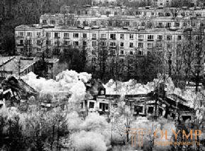
Fig. 112. Demolition of "Khrushchev"
Multi-storey building (from 6 floors and above)
This type of building currently prevails in large and major cities.
Advantages: high intensity of land use, minimization of the cost of transport, engineering communications and landscaping, relatively low cost of housing (taking into account the cost of land and the cost of communication).
Disadvantages: lack of communication with the external living environment; limited insolation of residential areas, an increase in the cost of construction and operation due to the need to build elevators (with the number of floors above 10 floors of non-smokeable stairs).
High-rise buildings (more than 75 m)
Advantages: the ability to create a vertical dominant in the overall composition of the building, as a rule, an attractive view from the window.
Disadvantages: environmental inferiority of housing.
High-rise buildings have significant features: high load on supporting structures, significant horizontal (wind) loads, the need to create additional engineering units (technical floors), increased requirements for fire safety, etc. It is considered economically expedient to limit the height of residential construction to 100 meters. If it is necessary to create an expressive silhouette (image) of the city (fig. 113), the high cost is neglected, but most often high-rise buildings are not built in residential but office buildings.

Fig. 113. Competition in high-rise construction
Multi-storey building
Advantages: high density, efficiency, variety of housing types; opportunities for the formation of an expressive silhouette.
Что бы оставить комментарий войдите
Комментарии (0)