Earthquakes - tremors and vibrations of the Earth's surface, caused by natural causes (mainly tectonic processes), or artificial processes (explosions, filling of reservoirs, collapse of underground cavities of mine workings). Small shocks can also be caused by the rise of lava during volcanic eruptions.
Earthquakes
The powerful manifestation of the internal forces of the Earth, expressed by the oscillations of the earth's surface during the passage of seismic waves from an underground energy source, is called an earthquake. There are three types of seismic waves:
- Longitudinal waves. They compress and stretch the rock, creating tension in it in the direction of wave propagation. They pass at the speed of sound through solid and liquid media.
- Transverse waves - shear particles of matter to the sides at a right angle to the direction of the wave at a speed of about 4.5 km / s. They are distributed only in solid media.
- Surface waves have a period of oscillation longer than longitudinal and transverse waves. They are called waves of gravity.
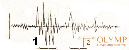
For recording earthquakes, instruments for recording oscillations are used — seismographs, which record them in the form of graphs — seismograms (Figure 11).

Figure 11. Seismogram: 1 - longitudinal wave, 2 - transverse.
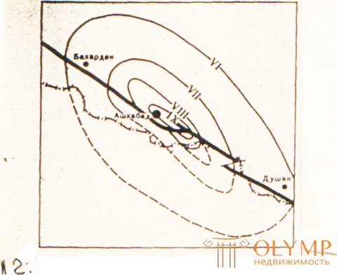 The region of the Earth, where suddenly, potential energy is explosively released, is called the hypocenter, and its projection onto the Earth's surface is the epicenter. The region of greatest destruction is located around the epicenter - the pleistoseist region The lines connecting points with the same intensity of vibrations (in points) are called isoseistists (Figure 12).
Figure 12. Scheme of the isoseist of the Ashgabat pottery earthquake (1948).
The distance between the hypocenter and the epicenter is the depth of the seismic source. According to the depth of the seismic source, earthquakes are divided into surface (up to 10 km), normal (10-75 km), deep (75-300 km) and very deep (300-700 km).
The hypocenter may shift in depth when earthquakes repeat.
The hypocenter is called the center as an earthquake point purely arbitrary, since it is most often a fracture along a fracture and, depending on the fracture energy, the magnitude and inclination of such a fracture are different.
From the hypocenter, the waves, gradually fading, diverge by distances of up to several thousand kilometers. The distribution range depends largely on the geological structure of the area. In mountainous areas, the waves attenuate much faster than on the plain. During the Ashgabat earthquake of 1948, the shock waves spread in the direction of the West Siberian Plain to 2500 km.
The speed of propagation of seismic waves depends on the elasticity and density of the rock. Moving from a more dense elastic medium to a less dense and elastic or vice versa, seismic waves experience reflection and refraction, which is recorded on a seismogram and allows you to designate the boundaries of layers of rocks of different composition, density, humidity, and then, using standards, build a geological section.
Depending on the causes of earthquakes, they are divided into endogenous (tectonic), exogenous (landslide), volcanic and anthropogenic, associated with human activity - explosions, underground tests, accidents at large hydroelectric power stations, etc. The most dangerous are tectonic, since their energy released during an earthquake is very significant.
The strength of earthquakes is estimated on the scales of magnitudes (M) and magnitudes (J). According to the magnitude scale, known as the Richter scale, the magnitude of any earthquake is defined as the decimal frequency of the maximum amplitude of the seismic wave (expressed in microns) recorded by a standard seismograph at a distance of 100 km from the epicenter.
Known maximum magnitudes M = 8.5 -9. Magnitude is a calculated value, a relative characteristic of a seismic focus, used to estimate the total energy released in the focus (a functional relationship between magnitude and energy is established).
The magnitude of the largest earthquakes corresponds to an energy release of 1017-1018J.
The intensity of the manifestation of earthquakes on the surface of the earth (the shakiness of the surface) is determined by the scales of seismic intensity and is estimated in arbitrary units - points. In Russia, as in most countries of the world, the 12-point MSK-64 international seismic scale is used.
In the textbook V.P. Ananeva, A.D. Potapova (2002) provides a formula for calculating a ball: 
The ball (J) is a function of the magnitude (M), the depth of the source (h) and the distance from the point under consideration to the epicenter (L).
The magnitude is determined by the seismogram. When assessing the destructive impact of a seismic wave, the angle at which it comes from the hypocenter to the surface of the Earth is of great importance. The resulting seismic wave decomposes into two components - normal and horizontal (Figure 13). At the epicenter, the structure will experience only vertical shocks. The greatest damage occurs under the action of the horizontal component of the seismic wave, which should be considered when assessing the destructiveness of an earthquake.
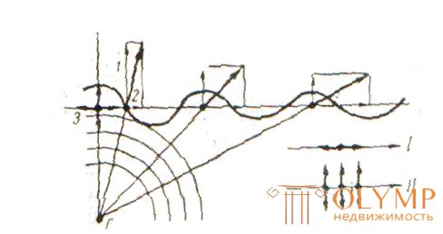
Figure 13. Earthquake mechanism:
G - hypocenter; E - epicenter; 1 - the vertical component of the seismic wave;
2 - the horizontal component of a sesymic wave; I - oscillations of particles at longitudinal; II– oscillations of particles at transverse waves.
For the entire territory of the country, depending on the geological structure and tectonics, areas of seismic hazard of different magnitudes are identified. These areas are confined to the mountain systems: Crimea, Central Asia, the Far East, Kamchatka, Sakhalin, Mongolia, and others. The seismic map shows areas and zones, for each of which the potential seismic hazard is indicated in points from 6 to 9. It is set for average geological conditions that may be different. Therefore, microseismonioning is introduced in the areas under protection in seismically dangerous areas. The intensity of the earthquake in the points indicated on the seismic zoning map, in this case, can be adjusted by ± 1-2 points depending on local tectonic conditions, geomorphology, soil and hydrogeological conditions, as well as the type of structures.
Construction in seismically hazardous areas is carried out taking into account the requirements of building codes and regulations approved for these areas. It should be borne in mind that during earthquakes, large mudflows are possible, the occurrence of seismic landslides and landslides, the phenomena of liquefaction of fine-grained and fine-grained water-saturated sands, their transition to a floating state.
When earthquakes occur on the seabed (seaquake), giant waves are formed, which, falling on the shore, cause great damage.
2.3. Global Earth tectonics (plate tectonics).
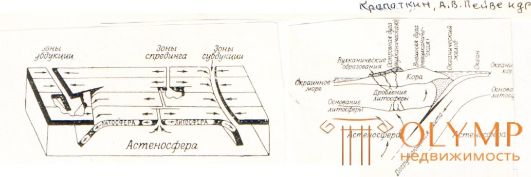
There are quite a few scientifically-based proposals (tectonic hypotheses) about the causes of the movement and deformation of the earth's crust, creating its structures. However, questions about the causes of tectonic deformations still can not be considered finally resolved. The hypothesis of the “new global tectonics” proposed in the 60s – 70s of the 20th century by X. Hess, R. Didom and others is most popular. The new global tectonics assumes the existence of subcortical convection currents and is based on the data of paleomagnetism and the results of sea bottom drilling . According to the "new global tectonics", a relatively "fragile" lithosphere, underlain by the plastic asthenosphere, is divided into rigid plates separated from each other by tectonic breaks. Plates include continents and parts of the oceans and experience a spreading (spreading) with respect to each other to form rift zones, and then oceans; a feat (subduction) with immersion of one plate under another (Figure 14, 15) or transform faults are formed. This is a long-acting right or left-side shifts. In the process of creation or destruction of the crust are not involved. Here, shear and discontinuous dislocations prevail. In our country, the questions of the “new global tectonics” were developed by academicians V. Ye. Hein, P. I. Kropotkin, A. V. Peive, and others.
|
Fig. 14. Block diagram showing the dynamics of nucleation (spreading) and absorption (subduction) of the lithosphere (after B. Asex et al., 1968). |
Fig. 15. Scheme of subduction of the ocean floor.
|
Currently, seven large plates are distinguished in the upper shell of the Earth: Pacific, Eurasian, Indo-Australian, Antarctic, African, North-South American (Figure 16). Within large plates, medium and small plates or blocks are distinguished. All plates move relative to each other, therefore their borders are clearly marked with zones of high seismicity.



Figure 16. Plate layout.
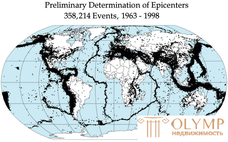
Figure - the frequency of occurrence of earthquakes from 1963 to 1998 based on 358214 events.
About one million earthquakes occur throughout the Earth every year, but most of them are so insignificant that they go unnoticed. Really strong earthquakes, capable of causing extensive destruction, occur on the planet about once every two weeks. Most of them are at the bottom of the oceans, and therefore are not directly accompanied by catastrophic consequences (an earthquake under the ocean causes a tsunami).
Earthquakes are best known for the devastation they can produce. Destruction of buildings and structures caused by fluctuations in the soil or giant tidal waves (tsunamis), resulting priseismic displacements on the seabed.
Most earthquake foci occur near the surface of the Earth.
Earthquakes can also be caused by landslides and large landslides. Such earthquakes are called landslide, they have a local character and a small force.
Volcanic earthquakes are a type of earthquake, in which shocks result from a high voltage in the bowels of a volcano. The cause of such earthquakes is lava, volcanic gas. Earthquakes of this type are weak, but last for a long time, many times over - weeks and months. However, the danger to people of the earthquake of this type is not.
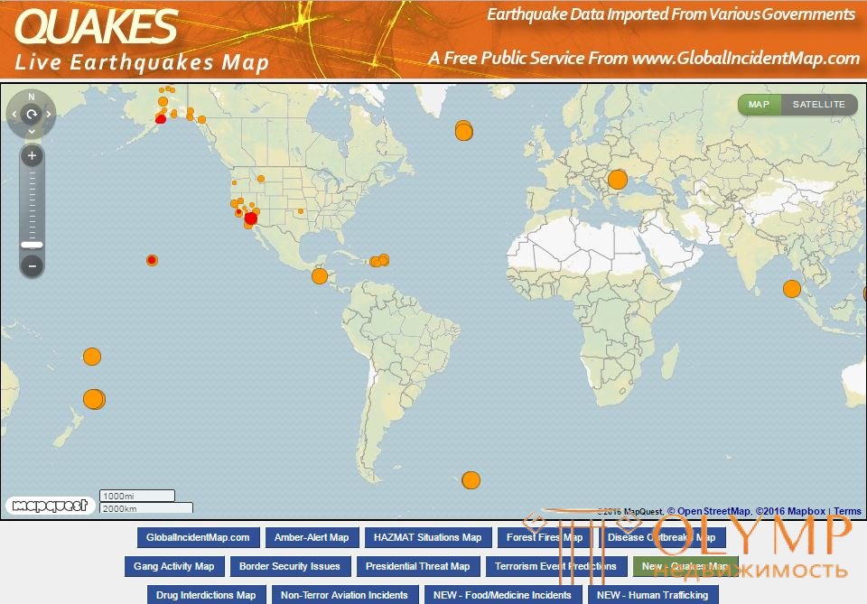
Figure - free online service for viewing earthquakes http://quakes.globalincidentmap.com
Earthquakes in the Urals
“The steps of the river terraces, a particularly illustrative indicator of the tectonic movements of the Urals, make it possible to trace both the long and close history of the ascent of the mountains in great detail. The generally recognized average growth rate of the Urals is about two millimeters per century. However, in some places, the Ural Mountains grow by five or more millimeters per year. Of course, in comparison with actively developing high seismic mountain systems - Tien Shan, Pamir, the Caucasus and others - the ancient Urals are in no hurry. There are relatively few earthquakes recorded here. But this is quite enough for an urgent, comprehensive study of the modern geological processes of the development of the Urals and their influence on human activity. ”
L.V. Bankovsky (1975) [1]
The cause of the earthquake is the rapid displacement of a portion of the lithosphere (lithospheric plates) as a whole at the time of relaxation (discharge) of the elastic deformation of strained rocks in the earthquake source. Most earthquake foci occur near the surface of the Earth.
According to the scientific classification, the depth of occurrence of earthquakes are divided into 3 groups: “normal” - 33–70 km, “intermediate” - up to 300 km, “deep-focus” - over 300 km. The latter group includes an earthquake that occurred on May 24, 2013 in the Sea of Okhotsk, while seismic waves reached many parts of Russia, including Moscow. The depth of this earthquake reached 600 km.
Slip rocks first prevent friction. As a result, the energy that causes the movement accumulates in the form of elastic stresses of the rocks. When the stress reaches a critical point exceeding the friction force, a sharp rupture of the rocks occurs with their mutual displacement; The accumulated energy, released, causes wave oscillations of the earth's surface - earthquakes. Earthquakes can also occur when the rocks collapse into folds, when the value of the elastic stress exceeds the tensile strength of the rocks, and they break up, forming a fracture.
Seismic waves generated by earthquakes propagate in all directions from the source like sound waves. The point at which the movement of rocks begins is called a focal point , a focus, or a hypocenter , and a point on the earth's surface above the focus is called the epicenter of an earthquake. The shock waves propagate in all directions from the source, and as they move away from it, their intensity decreases.
Seismic velocity can reach 8 km / s.
Seismic waves are divided into compression waves and shear waves .
There is a third type of elastic waves - long or surface waves (L-waves). They cause the most severe destruction.
For assessing and comparing earthquakes, a magnitude scale (for example, the Richter scale) and various intensity scales are used.
Scale magnitude. Richter scale
The magnitude scale distinguishes earthquakes by magnitude magnitude, which is a relative energy characteristic of an earthquake. There are several magnitudes and correspondingly magnitude scales: local magnitude (ML); magnitude determined by surface waves (Ms); magnitude determined by bulk waves (mb); moment magnitude (Mw).
The most popular scale for assessing earthquake energy is the local Richter magnitude scale. On this scale, an increase in magnitude per unit corresponds to a 32-fold increase in the released seismic energy. An earthquake with a magnitude 2 is barely perceptible, while magnitude 7 meets the lower boundary of devastating earthquakes covering large areas. The intensity of earthquakes (can not be estimated by magnitude) is estimated by the damage they cause in populated areas.
Intensity scale
The intensity is a qualitative characteristic of an earthquake and indicates the nature and scale of the impact of an earthquake on the surface of the earth, on people, animals, as well as on natural and man-made structures in the area of an earthquake. There are several intensity scales in the world: in Europe — the European Macroseismic Scale (EMS), in Japan — the scale of the Japan Meteorological Agency (Shindo), in the USA and Russia — the modified Merkalli Scale (MM):
Medvedev-Shponheuer-Karnik Scale (MSK-64)
The 12-point scale of Medvedev-Shponheuer-Karnik was developed in 1964 and became widespread in Europe and the USSR. Since 1996, a more modern European macroseismic scale (EMS) has been applied in the countries of the European Union. MSK-64 forms the basis of SNiP II-7-81 “Construction in seismic regions” and continues to be used in Russia and the CIS countries. Kazakhstan currently uses SNiP RK 2.03-30-2006 "Construction in seismic areas".
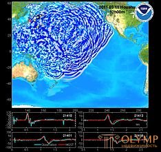
Tsunami waves in the Pacific, Japan Earthquake (2011)
An earthquake begins with a rupture and movement of rocks deep in the earth. This place is called the earthquake focus or hypocenter. Its depth is usually no more than 100 km, but sometimes it reaches 700 km. The focal depth is distinguished by normal (70–80 km), intermediate (80–300 km), and deep earthquakes (more than 300 km) [2].
In some cases, the layers of the earth, located on the sides of the fault, approach each other. In others, the land on one side of the fault falls, forming faults. In places where they cross river beds, waterfalls appear. The vaults of underground caves crack and collapse. It happens that after an earthquake large areas of land are lowered and flooded with water. Tremors displace the upper, loose layers of soil from the slopes, forming landslides and landslides. During the earthquake in California in 1906, at a site of 477 kilometers, displacements of soil were observed to a distance of 6–8.5 m [3].
Underwater earthquakes cause tsunamis, long waves caused by a powerful impact on the entire water column in the ocean, during which there is a sharp displacement (raising or lowering) of the seabed. Tsunamis are formed during earthquakes of any force, but those that arise due to strong earthquakes (more than 7 points) reach a large force.
It is clear that the sharp movement of large masses of earth in the hearth must be accompanied by a blow of tremendous force.
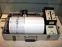
Seismograph
To detect and record all types of seismic waves, special instruments are used - seismographs . In most cases, the seismograph has a spring-attached load, which during an earthquake remains stationary, while the rest of the instrument (body, support) starts moving and is displaced relative to the load. Some seismographs are sensitive to horizontal movements, others to vertical ones. Waves are recorded with a vibrating feather on a moving paper tape. There are electronic seismographs (without paper tape).
Volcanic earthquakes are a type of earthquake, in which shocks result from a high voltage in the bowels of a volcano. The cause of such earthquakes is lava, volcanic gas. Earthquakes of this type are weak, but last for a long time, many times over - weeks and months. However, the danger to people of the earthquake of this type is not.
Recently there have been suggestions that earthquakes may be caused by human activity. For example, in areas of flooding during the construction of large reservoirs, tectonic activity increases - the frequency of earthquakes and their magnitude increases. This is due to the fact that the mass of water accumulated in the reservoirs increases the pressure in the rocks with its weight, and the seepage water reduces the tensile strength of the rocks. Similar phenomena occur during oil and gas production (a series of earthquakes with a magnitude of up to 5 occurred at the Romashkinskoye oil field in Tatarstan) and the extraction of large quantities of rock from mines, quarries, and the construction of large cities from imported materials.
Earthquakes can also be caused by landslides and large landslides. Such earthquakes are called landslide, they have a local character and a small force.
An earthquake can also be caused artificially: for example, by the explosion of a large amount of explosives or by an underground nuclear explosion (a tectonic weapon). Such earthquakes depend on the amount of exploded matter. For example, during the test of the DPRK nuclear bomb in 2006, an earthquake of moderate strength occurred, which was recorded in many countries.
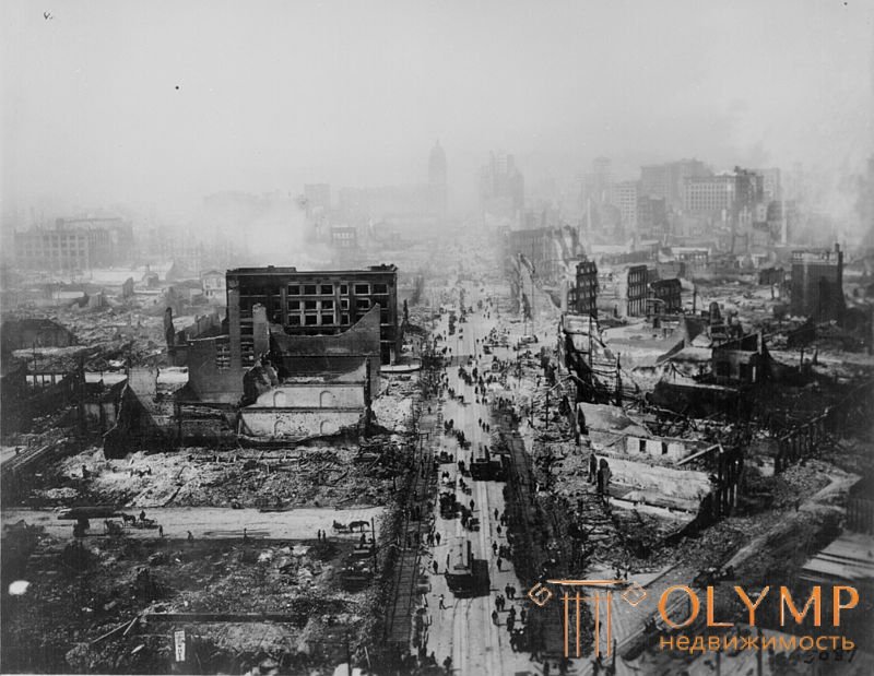
The consequences of a catastrophic earthquake in San Francisco, USA in 1906
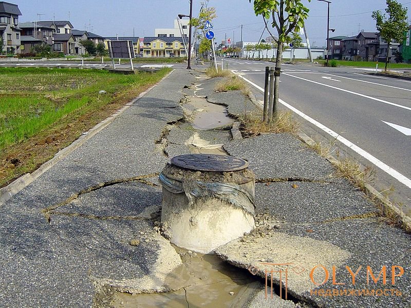
Consequences of the earthquake in Japan - the road broke
Main article: The most destructive earthquakes in human history
The earthquake in Ganja is one of the largest [4] [5] earthquakes in history with a magnitude of 11, which occurred on September 30 [6] in 1139 near the city of Ganja on the territory of the modern Azerbaijan Republic. As a result of the disaster killed 230 thousand people.
During the earthquake, Mount Kapaz collapsed and blocked the riverbed of the Ahsu River, which ran through it, as a result of which eight lakes were formed, one of which was Goygol Lake. This lake is currently located on the territory of the reserve of the same name [7] [8].
This earthquake is one of the five earthquakes that claimed the largest number of lives [9].
The great Chinese earthquake (Ch. 嘉靖 大 地震) occurred in the province of Shaanxi on January 23, 1556. It claimed the lives of approximately 830,000 people - more than any other earthquake in the history of mankind. The epicenter of the Shensi earthquake was located in the valley of the Wei River in the province of Shaanxi, near the cities of Huixian, Weinan and Huayin. In Huaxiang, all buildings were destroyed, more than half the population died. At the epicenter of the earthquake opened 20-meter dips and cracks. Destruction affected areas located 500 km from the epicenter. Some areas of Shaanxi completely depopulated, in others about 60% of the population died. Such a number of victims was due to the fact that most of the population of the province lived in loess cave, which collapsed after the first jolts or were flooded by mudflows [10]. After six months after the earthquake, aftershocks followed several times a month [11].
The Jamaican earthquake of 1692 was an earthquake that occurred in the city of Port Royal (Jamaica) on June 7, 1692 at exactly 11:43 in accordance with the stopped clock found at the bottom of the bay [12]. Most of the city, known as the “treasury of the West Indies” and “one of the most immoral places on Earth,” was flooded by the sea. About 2 thousand people died as a result of an earthquake and tsunami, about 3 thousand more - from injuries and spreading diseases [12].
The Sicilian earthquake of 1693 or the Great Sicilian is one of the largest earthquakes in the history of Sicily. The earthquake occurred on January 11, 1693 during the eruption of Etna and caused destruction in southern Italy, Sicily and Malta. Killed from 60 to 100 thousand people [13] [14]. Southeastern Sicily suffered the most. It was in the area of Val di Noto, which was almost completely destroyed, a new late Baroque architectural style was born, known as "Sicilian Baroque" [15].
Hoei's earthquake (Jap. 宝 永 地震Ho: hey Jinin ?) - The earthquake that struck at 14:00 local time on October 28, 1707 was the strongest in Japanese history [16] before the 2011 Sendai earthquake, surpassing it, but yielding to earthquakes in the country of 1896, 1995 and 1923 (the hardest in consequence) years. As a result, areas of south-western Honshu, Shikoku and southeastern Kyushu were damaged from medium to heavy [17]. The earthquake and the destructive tsunami caused by it caused the death of more than five thousand people [18]. This earthquake with a magnitude of 8.6 may have caused an eruption of the Fuji volcano that occurred 49 days later [19].
The Assame earthquake of 1897 - an earthquake that occurred on June 12, 1897 in Assam, British India. According to estimates, its magnitude was 8.1 Mw [20]. It is believed that the hypocenter was located at a depth of 32 km. The Assame earthquake left in ruins stone buildings on an area of 390,000 km², and all affected more than 650,000 km² from Burma to New Delhi. The main blow was followed by a large number of aftershocks - aftershocks. Given the magnitude of the earthquake, the mortality rate was not so high (about 1,500 victims), but the material damage was very significant. The earthquake occurred on the south-south-western outcrop of the Oldham break, on the northern edge of the Shillong Plateau of the Indian Plate [21] [22]. The minimum displacement of the earth's surface was 11 m, with peaks up to 16 m. This is one of the largest vertical displacements of all measured earthquakes [21]. The calculated offset region has spread 110 km along the shear line over the surface, and from 9 to 45 km below the surface. In fact, the entire earthquake was involved in the earthquake. Changes in the relief were so pronounced that almost the entire area has changed beyond recognition.
The Shmakhi earthquake with a magnitude of 6.9, which occurred on February 13 (January 31, Julian calendar) in 1902 on the territory of the modern Azerbaijan Republic, was the strongest earthquake in the entire history of the city of Shemakha, which destroyed almost the entire city. About 4,000 homes were destroyed and over 3,000 victims [23] were buried beneath these debris.
The earthquake of Messina (Italian. Terremoto di Messina) of magnitude 7.5 occurred on December 28, 1908 in the Strait of Messina between Sicily and the Apennine Peninsula. As a result, the cities of Messina and Reggio Calabria were destroyed. This earthquake is considered the strongest in the history of Europe [24]. The earthquake began at about 5:20 am on December 28 at sea, at the bottom of the Strait of Messina. The shocks caused a shift in the bottom sections, after which three tsunami waves up to three meters high struck Messina at intervals of 15–20 minutes. In the city itself, within one minute, there were three severe blows, after the second, buildings collapsed. In total, more than twenty settlements in the coastal strip in Sicily and Calabria suffered from the earthquake. Repeated pushes continued in January 1909.
There are different estimates of the total number of fatalities, the maximum figure is 200,000 people [24].
The Great Kanto Earthquake (Jap. 関 東 大 震災Kanto: Dassinsai ?) - a strong earthquake (magnitude 8.3), on September 1, 1923, occurred in Japan. The name was given to the Kanto region, which suffered the most damage. In the West, it is also called Tokyo or Yokohama, since it almost completely destroyed Tokyo and Yokohama. The earthquake caused the death of several hundred thousand people and caused considerable material damage. The earthquake began on September 1, 1923, in the afternoon. Its epicenter was located 90 km south-west of Tokyo, on the seabed, near the island of Oshima in Sagami Bay. In just two days, 356 aftershocks occurred, of which the first were the strongest. In the Gulf of Sagami, due to the changing position of the seabed, 12-meter waves of tsunami rose, which devastated coastal settlements. In terms of the scale of damage and the number of victims, this earthquake is the most devastating in the entire history of Japan (but not the strongest, so the 2011 earthquake was more powerful, but it caused less severe consequences).
Crimean earthquake of 1927 - an earthquake on the Crimean peninsula, which occurred on June 26, 1927. Despite the fact that earthquakes occurred in the Crimea since ancient times, the most famous and most devastating earthquakes occurred in 1927. The first of them happened on the afternoon of June 26th. The strength of the earthquake on June 26 was 6 points on the South Bank. It did not cause any serious damage and casualties, however, as a result of the panic that arose in some places, it was not without victims. The focal area of the earthquake was located under the bottom of the sea, south of the villages of Foros and Mshatka, and probably stretched across the coast. Already during the earthquake itself, the fishermen, who were at sea on June 26, 1927 at 13:21, noted an unusual excitement: when the weather was absolutely quiet and clear, a small swell formed on the water and the sea seemed to be boiling. Before the earthquake, it remained completely quiet and calm, and during the pushes there was a strong noise.
Ashgabat earthquake - an earthquake that occurred on the night of 5 to 6 October 1948 at 1:14 local time in the city of Ashgabat (Turkmen SSR, USSR). It is considered one of the most destructive earthquakes, the force in the epicentral region was 9-10 points, the magnitude of the earthquake was M = 7.3. As a result of the earthquake in Ashgabat, 90-98% of all buildings were destroyed. According to various estimates, from 1/2 to 2/3 of the population of the city died (that is, from 60 to 110 thousand people, as information about the number of inhabitants is inaccurate) [25]. Currently, Turkmenistan believes that the earthquake claimed the lives of 176 thousand inhabitants [26].
Since 1995, the date October 6 was legalized in Turkmenistan as Memorial Day.
The Great Chilean Earthquake (sometimes - Valdiv Earthquake , used by Terremoto de Valdivia) - the strongest earthquake in the history of observation, magnitude - according to various estimates from 9.3 to 9.5, occurred on May 22, 1960 at 19:11 UTC in Chile. The epicenter was located near the city of Valdivia (  38 ° 16 ′ S W.73 ° 03 ′ h. D. (G) (O)) 435 kilometers south of Santiago. The waves of the tsunami reached a height of 10 meters and caused significant damage to the city of Hilo in Hawaii approximately 10 thousand kilometers from the epicenter, the remains of the tsunami reached even the shores of Japan. The number of victims was about 6 thousand people, and most of the people died from the tsunami.
The great Alaskan earthquake is the strongest earthquake in US history and the second, after Valdivsky, in the history of observations, its magnitude was 9.1-9.2. The earthquake occurred on March 27, 1964 at 17:36 local time (UTC-9). The event fell on Good Friday and in the USA is known as Good Friday Earthquake . The hypocenter was located in the College Fjord, northern Alaska Gulf, at a depth of more than 20 km at the junction of the Pacific and North American plates. The great Alaskan earthquake caused destruction in the settlements of Alaska, Anchorage, located 120 km west of the epicenter, suffered the most from large cities.
The Tashkent earthquake is a catastrophic earthquake (magnitude 5.2), which occurred on April 26, 1966 at 5 hours 23 minutes in Tashkent. With a relatively small magnitude (M = 5.2), due to the shallow depth (from 3 to 8 km) of the center, it caused 8-9-point (12-point MSK-64 scale) ground surface shake and significant damage to building objects downtown. The zone of maximum destruction was about ten square kilometers. On the outskirts of the capital, the seismic effect barely reached 6 points. Strong fluctuations in the soil with a frequency of 2–3 Hz lasted 10–12 seconds. A relatively small number of victims (8 dead and several hundred injured) in a city with a population of one million owes to the predominance of vertical (rather than horizontal) seismic vibrations, which prevented a complete collapse of even dilapidated mud houses. Analysis of the causes of injuries showed that in 10% of cases they were received from the collapse of walls and roofs, 35% from falling structural parts of buildings and structures (plaster, plaster molding, bricks, etc.) and household items. In 55% of the causes of injuries were the unconscious behavior of the victims themselves, due to panic and fear (jumping from the upper floors, bruises on various objects, and the like). However, subsequently the number of deaths increased as a result of heart attacks in the period of occurrence of even minor aftershocks.
The earthquake in Tangshan (Chinese: 大 地震) was a natural disaster that occurred in the Chinese city of Tangshan (Hebei Province) on July 28, 1976. An earthquake of magnitude 8.2 is considered the largest natural disaster of the 20th century. According to official figures from the authorities of the People's Republic of China, the death toll was 242,419, but according to some estimates, the death toll reaches 800 thousand. The suspicion of understatement of official Chinese data is supported by the fact that the magnitude of the earthquake was only 7.8. At 3:42 local time the city was destroyed by a strong earthquake, the hypocenter of which was located at a depth of 22 km. The destruction also took place in Tianjin and in Beijing, located just 140 km to the west. Due to the earthquake, about 5.3 million homes were destroyed or damaged so that it was impossible to live in them. A few aftershocks, the strongest of which had a magnitude of 7.1, led to even more victims.
Spitak earthquake (. Arm Սպիտակի երկրաշարժ), also known as Leninakan earthquake (arm Լենինականի երկրաշարժ.) - catastrophic magnitude earthquake 7.2 [27], 7 December 1988 occurred at 10 hours 41 minutes Moscow time in the northwest Armenian SSR . As a result of the earthquake, the city of Spitak and 58 villages were completely destroyed; частично разрушены города Ленинакан (ныне Гюмри), Степанаван, Кировакан (ныне Ванадзор) и ещё более 300 населённых пунктов[28]. Погибли по крайней мере 25 тысяч человек, 514 тысяч человек остались без крова[27]. В общей сложности, землетрясение охватило около 40 % территории Армении[27]. Из-за риска аварии была остановлена Армянская АЭС.
Землетрясение в Кобе (яп. 阪神・淡路大震災) — одно из крупнейших землетрясений в истории Японии. Землетрясение произошло утром во вторник 17 января 1995 года в 05:46 местного времени. Магнитуда составила 7,3 по шкале Рихтера. По подсчётам, во время землетрясения погибло 6 434 человек. Последствия стихии: разрушение 200000 зданий, 1 км скоростного шоссе Хансин, уничтожение 120 из 150 причалов в порту Кобе, нарушения электроснабжения города. Жители боялись вернуться домой из-за подземных толчков, которые продолжались несколько дней. Ущерб составил примерно десять триллионов иен или 102,5 млрд долларов США, или 2,5 % от ВВП Японии в то время.
Землетрясение в Нефтегорске — землетрясение магнитудой около 7,6, произошедшее ночью 28 мая 1995 в 1:04 местного времени на острове Сахалин. Оно полностью разрушило посёлок Нефтегорск — под обломками зданий погибло 2040 человек[29] из общего населения в 3197 человек[30]. Также в ту ночь сильным толчкам подверглись города и посёлки севера Сахалина. В городе Оха — центре Охинского района Сахалинской области, c населением около 30 000, толчки достигали не менее 6 баллов. Не выдержали козырьки подъездов в некоторых домах.
Измитское землетрясение — землетрясение (магнитуда 7,6), произошедшее 17 августа 1999 года в Турции в 3:01 по местному времени[31]. Центр располагался на глубине 17 км, эпицентр находился недалеко от промышленного города Измит (координаты 41.81ºс.ш. 30.08ºв.д.). В результате погибло более 18 тысяч человек, около 44 тысяч было ранено, около 500 000 осталось без крова.
Подводное землетрясение в Индийском океане , произошедшее 26 декабря 2004 года в 00:58:53 UTC (07:58:53 по местному времени), вызвало цунами, которое было признано самым смертоносным стихийным бедствием в современной истории. Магнитуда землетрясения составила, по разным оценкам, от 9,1 до 9,3. Этотретье по силе землетрясение за всю историю наблюдения.
Эпицентр землетрясения находился в Индийском океане, к северу от острова Симёлуэ, расположенного возле северо-западного берега острова Суматры (Индонезия). Цунами достигло берегов Индонезии, Шри-Ланки, юга Индии, Таиланда и других стран. Высота волн превышала 15 метров. Цунами привело к огромным разрушениям и огромному количеству погибших людей, даже в Порт-Элизабет, в ЮАР, в 6900 км от эпицентра.
Погибло, по разным оценкам, от 225 тысяч до 300 тысяч человек. По данным Геологической службы США (USGS), число погибших — 227 898[32]. Истинное число погибших вряд ли когда-либо станет известно, так как множество людей было унесено водой в море.
Сычуаньское землетрясение (кит. 四川大地震) — разрушительное землетрясение, произошедшее 12 мая 2008 года в 14:28:01.42 по Пекинскому времени (06:28:01.42UTC) в китайской провинции Сычуань. Магнитуда землетрясения составила 8 Mw согласно данным Китайского сейсмологического бюро и 7,9 Mw по данным Геологической службы США. Эпицентр зафиксирован в 75 км от столицы провинции Сычуань города Чэнду, гипоцентр — на глубине 19 км[33]. Это землетрясение также известно как Вэньчуаньское (кит. 汶川大地震), поскольку эпицентр землетрясения приходится на уезд Вэньчуань. Землетрясение ощущалось в Пекине (удаление 1,500 км) и Шанхае (1,700 км), где тряслись офисные здания и началась эвакуация[34]. Его почувствовали и в соседних странах: Индии, Пакистане, Таиланде, Вьетнаме,Бангладеш, Непале, Монголии и России. Официальные источники заявляют, что на 12 мая 2008 погибло 69 197 человек (www.cctv.com), пропало без вести порядка 18 тыс. человек, 288 431 пострадало[35]. Сычуаньское землетрясение явилось сильнейшим в Китае после Таншаньского землетрясения (1976), унёсшего около 250 000 жизней.
Землетрясение у восточного побережья острова Хонсю в Японии (яп. 東北地方太平洋沖地震То:хоку тихо: Тайхэйё:-оки дзисин ?, «Землетрясение в Тихом океане, оказавшее влияние на регион Тохоку»), также Великое восточнояпонское землетрясение (яп. 東日本大震災Хигаси Нихон дайсинсай ?) — землетрясениемагнитудой, по текущим оценкам, от 9,0[36] до 9,1[37] произошло 11 марта 2011 года в 14:46 по местному времени (05:46 UTC). Эпицентр землетрясения был определён в точке с координатами 38,322° с. ш. 142,369° в. д. восточнее острова Хонсю, в 130 км к востоку от города Сендай и в 373 км к северо-востоку от Токио[36]. Гипоцентрнаиболее разрушительного подземного толчка (произошедшего в 05:46:23 UTC) находился на глубине 32 км ниже уровня моря в Тихом океане. Землетрясение произошло на расстоянии около 70 км от ближайшей точки побережья Японии. Первоначальный подсчёт показал, что волнам цунами потребовалось от 10 до 30 минут, чтобы достичь первых пострадавших областей Японии. Через 69 минут после землетрясения цунами затопило аэропорт Сендай.
Это сильнейшее землетрясение в известной истории Японии[36] и седьмое[38], а по другим оценкам даже шестое[39], пятое[37] или четвёртое[40] по силе за всю историю сейсмических наблюдений в мире[41]. Однако по количеству жертв и масштабу разрушений оно уступает землетрясениям в Японии 1896 и 1923 (тяжелейшему по последствиям) годов.
«При описании каждого факта сотрясения почвы желательно было бы иметь сведения по следующим рубрикам: место наблюдаемого сотрясения и обширность простирания последнего; время наблюдения (год, месяц, число, час, минута и секунда); направление волны сотрясения; побочные явления, как, например, подземный шум, нередко слышимый в подобных случаях, направление этого шума и его свойства, трещины и расселины в земле и зданиях, направление этих трещин и расселин; общее состояние погоды предшествующей и последующей; …если сотрясение произошло вблизи озера или реки, то каково было движение вод озера или реки при общем сотрясении и не произошло ли при этом какого-либо изменения в относительном положении уровней воды и суши. При собирании таких фактов за прошлые времена мне кажется следовало бы обратить внимание на различные местные архивы, в которых должны сохраниться какие-либо сведения о потрясениях почвы; особенно желательно было бы в этом отношении пересмотреть заводские архивы и войти в сношения с лицами, долго живущими в известных местностях и более или менее интересующимися теми или другими местными происшествиями»
Alexander Petrovich Orlov (1875) [42]
At the end of the twentieth century, a group of well-known Western seismologists conducted a network debate [43], the main issue of which was “Is the reliable prediction of individual earthquakes a realistic scientific goal?”. All participants in the discussion, despite significant discrepancies in private matters, agreed that
Даже если бы точность измерений и несуществующая пока физико-математическая модель сейсмического процесса дали возможность с достаточной точностью определить место и время начала разрушения участка земной коры, магнитуда будущего землетрясения остаётся неизвестной. Дело в том, что всеSeismicity models that reproduce the earthquake recurrence schedule contain one or another stochastic generator that creates dynamic chaos in these models, described only in probabilistic terms. More clearly, the source of stochasticity can be qualitatively described as follows. Let the fracture front propagating during an earthquake approach a site of increased strength. The magnitude of the earthquake depends on whether this section is destroyed or not. For example, if the front of destruction goes further, the earthquake will become catastrophic, and if not, it will remain small. The outcome depends on the strength of the site: if it is below a certain threshold, the destruction will follow the first scenario, and if it is higher, the second. A “butterfly effect” occurs: a negligible difference in strength or stresses leads to macroscopic effects,which cannot be predicted deterministically, since this difference is less than any measurement accuracy. And the prediction of the place and time of an earthquake with an unknown and possibly quite safe magnitude has no practical meaning, unlike calculating the probability that a strong earthquake will occur.
Nevertheless, Chinese scientists, it would seem, have achieved great success in predicting earthquakes - for several years they have monitored the inclination of the surface, the groundwater level, and the content of radon (gas) in rocks. According to the researchers, all these parameters, except for seasonal changes, as well as perennial trends, should change dramatically several weeks or months before a major earthquake. However, on July 27, 1976, the Tangshan earthquake (8.2 according to Richter), unpredicted by scientists, occurred during which more than 650 thousand people were killed, which was one of the largest observations in history.
Суперземлетрясение (землетрясение мегатолчка, англ. Megathrust earthquake) — является землетрясением между пластинами земной коры, которое происходит взонах субдукции на разрушенных границах плит (конвергентных границах), когда одна тектоническая плита этой зоны сталкивается с другой. Этот тип землетрясений является самым мощным на планете, с магнитудой выше 9,0. Никакой другой известный вид источников активности не производит такого масштаба.
В разрывах земной коры одна сторона плиты выталкивается вверх по отношению к другой, именно этот тип движения известен как толчок. Термин «мегатолчок» не имеет общепринятого четкого значения, но используется для описания чрезвычайно большого надвигания плит одна на другую, как правило, сформованного в пределах зоны субдукции, такой как Сунда.
Самая большая зона субдукции связана с Тихим и Индийским океаном и ответственна за вулканическую активность Тихоокеанского огненного кольца. Поскольку эти землетрясения деформируют дно океана, они, почти, всегда создают большое количество цунами. Они, как известно, создают интенсивные толчки на протяжении определенного периода времени, который может продолжаться до нескольких минут.
Основная статья: Хронология землетрясений
| Таблица самых сильных землетрясений 20 века | |||
|---|---|---|---|
| A place | Дата землетрясения | Сила землетрясения | Coordinates |
| 1.Чили | 22 мая 1960 | 9.5 | −38,24/-73,05 |
| 2.Протока Принца Вильяма,Аляска, США | 28 марта 1964 | 9.2 | 61,02/-147,65 |
| 3.Возле западных берегов Южной Суматры | 26 декабря 2004 | 9.1 | 3,30/95,78 |
| 4.Камчатка | 4 ноября 1952 | 9.0 | 52,76/160,06 |
| 5.Япония | 11 марта 2011 | 8.9 | |
| 6.Возле побережья Эквадора | 31 января 1906 | 8,8 | 1,0/-81,5 |
| 7.Рет острова, Аляска, США | 13 октября 1963 | 8.7 | 51,21/178,50 |
| 8.Южная Суматра, Индонезия | 28 марта 2005 | 8.6 | 2,08/97,01 |
| 9.Андреановые острова, Аляска,США | 4 февраля 1965 | 8.6 | 51,56/-175,39 |
| 10.Ассам, Тибет | 15 августа 1950 | 8.6 | 28,5/96,5 |
| 11.Курильские острова | 13 октября 1963 | 8.5 | 44,9/149,6 |
| 12.Банда море, Индонезия | 1 февраля 1938 | 8.5 | −5,05/131,62 |
| 13.Камчатка | 3 февраля 1923 | 8.5 | 54,0/161,0 |
В связи с этим одним из актуальных заданий является прогнозирование места и силы землетрясения, что основано на наблюдениях за флуктуациями полей Земли. Фундаментальное задание — прогноз не только места и силы, но и времени землетрясения, решено только в некоторых случаях. Землетрясения могут вызываться искусственно(например, ядерными взрывами).
Предвидеть землетрясение точно, пока что невозможно, хотя есть ряд факторов прогнозирования (например, биофизические
Сейсмостойкое строительство — раздел гражданского строительства, специализирующийся в области изучения поведениязданий и сооружений под сейсмическим воздействием в виде сотрясений земной поверхности, потери грунтом своей несущей способности, волн цунами и разработки методов и технологий строительства зданий, устойчивых к сейсмическим воздействиям.
Сейсмостойкое строительство может рассматривать любой строительный объект как фортификационное сооружение, но предназначенное для обороны от специфического противника — землетрясения или вызванных землетрясением катастроф (например, цунами).
Главные задачи сейсмостойкого строительства:
Сейсмостойкое сооружение не обязательно должно быть громоздким и дорогим как, например, пирамида Кукулькана в городеЧичен-Ица[ источник не указан 276 дней ]. В настоящее время наиболее эффективным и экономически целесообразным инструментом в сейсмостойком строительстве является вибрационный контроль сейсмической нагрузки и, в частности,сейсмическая изоляция, позволяющая возводить сравнительно легкие и недорогие постройки.
Сейсмическое нагружение является одним из основных понятий в сейсмостойком строительстве и теории сейсмостойкости и означает приложение колебательного возбуждения землетрясения к различным сооружениям.
Величина сейсмической нагрузки в большинстве случаев зависит от:
Сейсмическое нагружение происходит на поверхностях контакта сооружения с грунтом, либо с соседним сооружением[2], либо с порождённой землетрясением гравитационной волной цунами. Оно постоянно экзаменует сейсмостойкость сооружения и иногда превышает его возможность выстоять без разрушений.
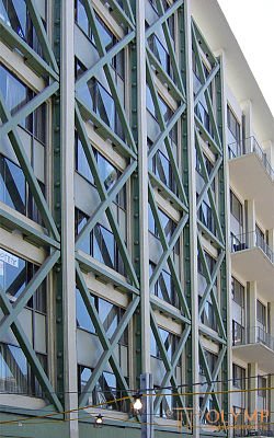
Наружная антисейсмическая стальная ферма спального корпуса Университета Беркли.
Прочность стали примерно в 10 раз выше, чем у самого прочного бетона и каменной или кирпичной кладки, поэтому сейсмостойкость строения обычно достигается использованием мощного стального каркаса или стен, способных выдержать расчётное землетрясение без полного разрушения и с минимальными человеческими жертвами. Примером такой постройки может служить спальный корпус Университета Беркли, усиленный наружной антисейсмической стальной фермой.
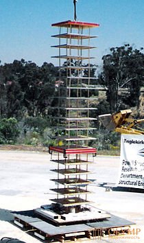
Модель 18-этажного здания насейсмопротекторе.
Seismic resistant construction, however, does not set a goal to build a practically indestructible building: it is more expedient and economically feasible to give the building the opportunity to “hover” above a shaking earth. To solve this problem, seismic protectors are used - a type of seismic isolation that dramatically increases the seismic resistance of buildings [3].
Main article: Earthquake Resistance Analysis
The analysis of seismic resistance is a tool in seismic construction, which serves to better understand the operation of buildings and structures under seismic load. The analysis of seismic resistance is based on the principles of the dynamics of structures [4] and anti-seismic design. The most common method for analyzing seismic stability was the method of reaction spectra [5], which has been developed now [6]. However, the reaction spectra are good only for systems with one degree of freedom. The use of stepwise integration with three-dimensional seismic resistance diagrams [7] is more effective for systems with many degrees of freedom and with significant non-linearity in the conditions of the kinematic buildup transient process.
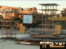
Two identical building models when tested on seismic platform: right - on seismoprotector, San Diego.
The study of seismic resistance is necessary to understand the actual work of buildings and structures under seismic load. Researches happen field (natural) and on a seismoplatform. It is most convenient to test a building model on a seismic platform that recreates seismic vibrations.
Concomitant seismic platform tests are usually carried out when it is necessary to compare the behavior of various modifications of a structure under the same seismic loading [8].
Vibration control is a system of devices that serve to reduce the seismic load on buildings. These devices can be classified into passive, active and hybrid [9].
Dry masonry walls
Dry masonry walls in the castle of the sun in Machu Picchu, Peru
The first builders, who paid special attention to the seismic stability of capital buildings (in particular, the walls of buildings), were the former and other inhabitants of Peru. The special features of the Inca architecture are unusually thorough and dense (so that it is impossible to push knife blades between the blocks) fitting stone blocks (often of irregular shape and different sizes) to each other without using mortars [10]. Due to this, the clutch had no resonant frequencies and stress concentration points, possessing additional strength of the roof. In case of earthquakes of small and medium strength, such masonry remained almost motionless, and in case of strong ones, the stones “danced” in their places, without losing their mutual position and at the end of an earthquake were placed in the same order [11]. These circumstances allow us to consider dry masonry walls one of the first in the history of passive vibration control devices of buildings.
Seismic shock absorber
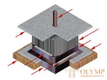
General view of the seismic shock absorber [1]

Seismic shock test in CSUN [en] [12]
A seismic shock absorber is a type of seismic isolation to protect buildings and structures from potentially destructive earthquakes [13].
Recently [ when? ] seismic dampers on roller bearings were installed in a residential 17-storey complex in Tokyo [14].
Inertia damper

Inertial damper on a high-rise building Taipei 101
Typically, an inertial damper (eng. Tuned Mass Damper ), also called an inertial damper, which is one of the devices for vibration control, is a massive concrete block installed on a high-rise building or other structure that oscillates with the resonant frequency of a given object using a special spring-like mechanism under seismic load.
For this purpose, for example, the inertial damper of the Taipei 101 skyscraper is equipped with a pendulum suspension in the form of a steel ball weighing 660 tons, located between the 92nd and 88th floors. Two other 6-ton vibration dampers are located at the top of the spire and are designed to dampen vibrations of the upper part of the building.
Hysteresis damper
Hysteresis damper (English Hysteretic damper ) is designed to improve the performance of buildings and structures under seismic load due to the dissipation of seismic energy penetrating into these buildings and structures. There are mainly four groups of hysteresis dampers, namely:
Each group of dampers has its own specifics, its own advantages and disadvantages, which should be considered when applying them.
Vertical Damping

Transamerica Pyramid Building in San Francisco, California
Vertical configuration damping (eng. Building elevation control ) is intended to improve the performance of buildings and structures under seismic load by preventing resonant oscillations using dispersion of seismic energy penetrating into these buildings and structures. Pyramidal buildings do not cease to attract the attention of architects and engineers also due to their greater stability in hurricanes and earthquakes.

Comparative tests on the vibrating table: on the left is the usual building model, on the right is the model damped by the vertical configuration of the building [15]
The conical profile of the building is not required for this vibration control method. A similar effect can be achieved using the appropriate configuration of such characteristics as the mass of floors and their rigidity [16].
Multi-frequency damper
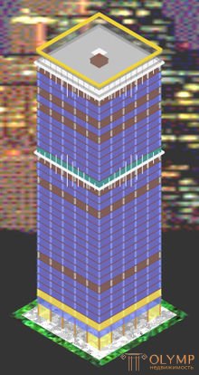
High-rise building with multifrequency quieter [17]
Multi-Frequency Quencher (English Multi-Frequency Quieting Building System , MUK) is a system of devices for vibration control, installed on a high-rise building or other structure, which oscillates with specific resonant frequencies of the object under seismic load.
Each MUK includes a series of interfloor diaphragms, framed by a set of protruding consoles with different periods of natural oscillations and operating as kinertial dampers. Using the MUK allows you to make the building both functional and architecturally attractive.
Raised base of the building
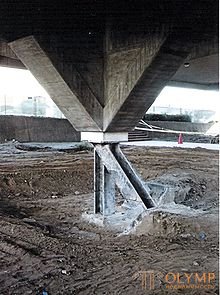
Reconstruction of the heel of the raised base [18]
Elevated building foundation (eng. Elevated building foundation ) is a vibration control tool in earthquake-resistant construction, which can improve the performance of buildings and structures under seismic load.
The effect of the elevated base of the building (POS) is based on the following. As a result of multiple reflections, diffractions and dissipations of seismic waves in the process of their propagation inside the REF, the transfer of seismic energy to the superstructure (upper part of the building) turns out to be greatly weakened [19].
This goal is achieved through an appropriate selection of building materials, structural dimensions, as well as the configuration of a PO for a specific construction site.
Lead-rubber support
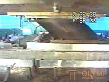
Vibration test lead-rubber supportLBRtest on YouTube
Lead rubber bearing (born Lead Rubber Bearing ) is a seismic insulation designed to improve the performance of buildings and structures under seismic load due to the intensive damping of seismic energy penetrating through these foundations into these buildings and structures. The image shows a test of a lead rubber grip made from a rubber cylinder with a lead core.
However, mechanically compliant systems, such as seismically isolated structures with relatively low horizontal rigidity, but with significant so-called damping force, can experience significant overloads caused by an earthquake just by this force [20].
Spring damper
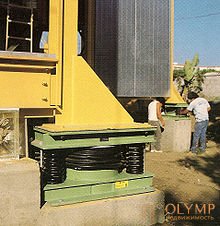
Spring damper under the three-story house
Spring damper (born Springs-with-damper Base Isolator ) is an insulating device, similar in design to a lead-rubber support. Two small three-story houses with such devices located in Santa Monica (California) were examined by the Northridge earthquake in 1994. Analysis of the results showed that the real resistance of buildings was several times worse than predicted [21] [22].
Friction pendulum bearing [edit | edit wiki text]
Friction pendulum support (eng. Friction Pendulum Bearing ) - is seismic isolation, which is a tool for vibration control in seismic resistant construction, which can improve the performance of buildings and structures under seismic load, consisting of the following main elements:
The study of seismic resistance includes both field, analytical and laboratory experiments aimed at explaining known facts or revising generally accepted views in the light of newly discovered facts and theoretical developments. The main practical method of obtaining new knowledge is still the survey of structures damaged by earthquakes.
The leading research organizations in the field of earthquake resistance are:


| 10.10.13 14:23 | 10 rules how to escape during an earthquake |
| Section: Emergency, Disaster and Survival | Posted by admin | Rating: 0.00 (0) Rate | Hits 1939 |
10 rules how to escape during an earthquake What to do during an earthquake. What to do during an earthquake.My name is Doug Kop. I am the commander of the Rescue Chief and Disaster Manager of the American Rescue Team International (ARTI) American Rescue Team. I penetrated inside 875 buildings destroyed by earthquakes, worked in rescue teams in 60 countries, organized and am a member of such brigades in many countries. For 2 years I was a UN expert on the study of the consequences of catastrophes and since 1985 not one of the serious catastrophes has been without my attention. The first building I was able to penetrate was a school in Mexico City during the 1985 earthquake. All the children were under their desks. They were all flattened by the thickness of their own bones. They could be saved if they were lying next to their desks in the aisles. It is unthinkable, from my point of view, but the children were instructed to hide under tables and desks during an earthquake. I was surprised, but in Mexican schools, such a “Duck and Cover” instruction is still in effect, bend over, cover your head with your hands and hide under the table. It is very easy to understand. When a building collapses, a heavy ceiling falls on an object or furniture, destroying them, forming a cavity or free space next to it. I call it the "triangle of life." The larger and stronger the object, the larger the cavity where a person can avoid injury and escape. This can be seen on TV when we see the work of rescue teams.
|
Моретрясения- это стихийное бедствие не менее, а может и более опасно. Последствия моретрясений могут оказаться такими же разрушительными, как и после землетрясений.
Последствиями моретрясений становятся гигантские волны, или, как их называют, цунами (однаком причинами цунами могут быть и другие явления). В открытом океане эти волны можно даже не заметить. Единственное, что их выделяет – это огромная скорость. Волны несутся со скоростью почти восемьсот километров в час. Вдумайтесь в эти цифры, с такой скоростью летают некоторые самолеты.
По мере приближения к берегу, волны начинают вырастать, а скорость их заметно падает. В такие моменты море как будто отступает назад, чтобы потом на берег обрушились несколько громаднейших волн. Высота таких волн достигает двадцати метров, сравнить это можно с городской шестнадцатиэтажкой.
В качестве примера можно привести одно из самых разрушительных моретрясений в истории человечества, которое произошло в 1755 году в столице Португалии Лиссабоне. На город обрушилась семнадцатиметровая волна. Последующие толчки довершили начатое волной: треть города просто стерло с лица Земли, более шестидесяти тысяч человек погибли.
Do not forget that the surface of our planet is constantly moving. Earthquakes of catastrophic power, of course, occur quite rarely. At the same time, seismologists register up to five hundred thousand aftershocks every year.
Что бы оставить комментарий войдите
Комментарии (0)