
Already in the XIX century. against the background of rapid urban development, there is a need for planning the development of large territories, settlement systems. The first projects covering significant areas and similar in nature to territorial planning (district planning) were the project for the development of the suburban zone of the city of Chicago and the project for planning the forest-park zones of Vienna and Budapest.
Many authors, in their proposals and concepts concerning the formation of the living environment of society, suggested forming systems of interconnected populated places. At the end of the XIX century. Spaniard Soria-i-Mata proposed a diagram of a linear structure connecting the two cities (Fig. 18). E. Howard in the concept of "city - garden" proposes to form associations from the city-gardens connected by transport communications (Fig. 17). R. Unwick in 1907 decided to apply the idea of a garden city in the construction of the city of Hampstead (a suburb of London).
By the beginning of the XX century. This includes the emergence of the idea of building satellite cities around a large city in order to solve the problem of its overpopulation (Fig. 19).

Fig. 17. E. Howard, group Rhys. 18. A. Soria-i-Mata, linear fig. 19. R. Whitten, System of city-gardens, 1898, the structure of the suburb of Madrid, 1884, satellite cities, 1923
In the first quarter of the XX century. a new independent project discipline dealing with resettlement, territorial planning (in the USSR - district planning) is gradually being formed.
Definition: territorial planning - planning the development of territories, including for establishing functional zones, zones of planned location of capital construction projects for state or municipal needs, zones with special conditions for using territories;
In the USSR, the first planning work of a whole region in 1924 was the general layout of the Absheron Peninsula.
In the 20s – 30s in the USSR, a search is under way for the development of the country's settlement system in a planned economy. The ideas of urbanism and disurbanism appear. New cities are being designed and built, new industrial areas are being formed.
1930s The projects of regional planning of a number of regions of the Urals, the non-Black Earth Center, Siberia, Donetsk and Krivoy Rog industrial areas, the southern coast of Crimea were developed.
In the 1940-50s. planning projects for the largest agglomerations of Europe are being implemented (Fig.
20, 21). The Big London Project, made under the guidance of
P.Aberkrombi, in which the interests of a developing megalopolis and suburban territories and settlements were linked (Fig. 22).
Fig. 20. Development project Copenhagen 1947 |
Fig. 21. Draft plan Stockholm, 1950s |
Fig. 22. The “Greater London” project under the leadership of P. Abercrombie, 1950s |
In the 60s. in connection with the scientific and technological revolution and the increasing urban planning activity in the world there is a surge of theoretical and conceptual research, as well as project activities in the field of spatial planning (Fig. 23, 24, 25).
In 1962, Japan held a competition for the development project of Tokyo (Fig. 23). A group of architects (headed by K. Tanga) put forward the idea of metabolism , the natural exchange of the city with the environment.
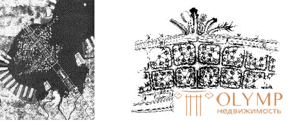
Fig. 23. Competition Project Figure. 24. Metabolic city, the development of Tokyo, 1962 K. Kurokawa, 1965
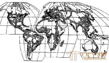
Fig. 25. 1968 K. Doxiadis “ecumenopolis project”. Forecast for 2100
In the 1960s there is a surge of futuristic ideas concerning future settlement. Giant structures (Fig. 26, 27, 29) and pyramids (Fig. 28, 30), sea and underwater settlements (Fig. 31, 33), mobile residential cells (Fig. 32), walking cities (Fig. 34) and others
 Fig. 26. I. Friedman, structure
over Paris, 1956 Fig. 27. J.-C. Bernard, Fig. 28. “Arcigram”,
total city city "Plug in city"

Fig. 29. A. Isozaki, project Fig. 30. Maimon, option Fig. 31. J. Djelik,
"Cluster" 1960s spatial city city on water
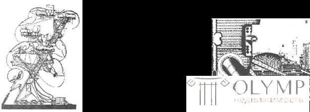 Fig. 32. Group
 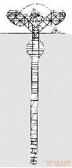 Fig. 34. Arkigrem,
Himmelblau. Project Fig. 33. Agrosean City "moving city" dynamic residential structure
By 1960-70 This includes a number of project proposals for the development of the existing settlement systems in the USA, France, England, Germany, etc. (Fig. 35-36).
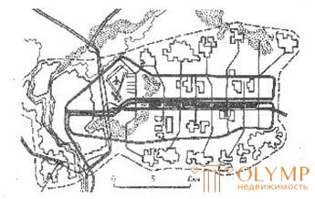
Fig. 35. The development scheme of Lyon, France
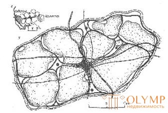
Fig. 36. The Redroz Settlement System,
Fragment of Liverpool-Manchester conurbation, UK
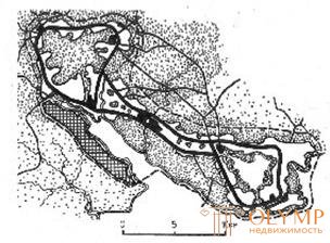
Fig. 37. Settlement system "Solent", UK
At present, territorial planning is developing as a complex project-scientific discipline. Territorial planning is an integral part of the development strategy of a state (region, territory).
Project discipline - regional settlement (territorial planning) is designed to solve the strategic tasks of resettlement, it develops within the framework of widely understood urban planning science and at the interface with other areas of knowledge.
Urban planning is increasingly interacting with related sectors: economics, geography, ecology, management theory, politics, sociology, engineering disciplines, etc.
Что бы оставить комментарий войдите
Комментарии (0)