4.1. Basic concepts
The terms and definitions of concepts in the field of digital mapping, as well as the use of digital and electronic maps and models are established by the interstate standard GOST 28441-99 “Digital cartography. Terms and Definitions".
In accordance with this standard, a digital terrain model (DTM) is a logical-mathematical representation in digital form of topographic and geodetic data about terrain objects and its characteristics. CMM includes:
metric information - geodetic spatial coordinates of characteristic points of relief and situation;
syntactic information for describing connections between points — the boundaries of buildings, forests, arable lands, reservoirs, roads, watersheds and spillways, the direction of the slopes between characteristic points on the slopes, etc .;
semantic information characterizing the properties of objects - technical parameters of engineering structures, geological characteristics of soils, data on trees in forests, etc .;
structural information describing the relationship between different objects - the relationship of objects to any set: separate points of the railway line, buildings and structures of the settlement, the structure and structure of the relevant industries, etc .;
general information - the name of the site, the system of coordinates and heights, the nomenclature.
Topographic CMM characterizes the situation and the terrain. It consists of a digital terrain model (DEMR) and a digital contour model (situation) for the terrain (MSCM). In addition, CMM can be supplemented by a model of special engineering purposes (CMIN). In engineering practice, a combination of digital models characterizing the situation, topography, hydrological, geotechnical, feasibility and other indicators are often used.
DTMs are created using special computer-aided design (CAD) modules such as AutoCad Land Development Desktop, Autodesk Civil 3D, Autodesk Map 3D, Pythagoras, Credo, GeoniCS, Topomatic Robur, and others
When solving engineering and geodetic problems on a computer, a mathematical interpretation of digital models is used, it is called a mathematical terrain model (MMM). Computer-aided design based on CMM and MMM reduces labor and time costs by tens of times compared to using paper topographic maps and plans for this purpose.
The initial data for creating digital terrain models are the results of topographic surveys, data on the geology and hydrography of the terrain.
4.2. Classification of digital terrain models
Classification of CMM by purpose corresponds to the general classification of maps: topographic, contour, geological, cadastral, etc.
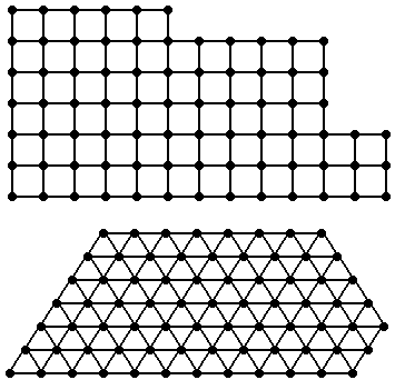
According to the method of placing the initial information and the rules of its processing on a computer, digital terrain models are divided into regular, irregular, structural (Fig. 34).
The digital terrain model in which the reference points with known coordinates are located at the nodes of geometric grids of various shapes, for example, in the form of a network of squares or equilateral triangles (Fig. 34, a), is called regular. Also use regular CMM at diameters to the main course (Fig. 34, b).
If there are large-scale maps and plans for a site, then they create a DTM in the form of an array of points located at certain intervals on the horizontal lines by moving the digitizer reticle horizontally (Fig. 34, c).
In regular CMM, the terrain geomorphology is not taken into account; therefore, it is preferable to use them for flat terrain.
but) 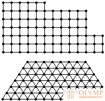 | b) 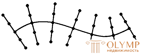 at) | ||
d) 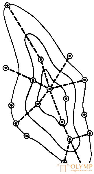 | d) 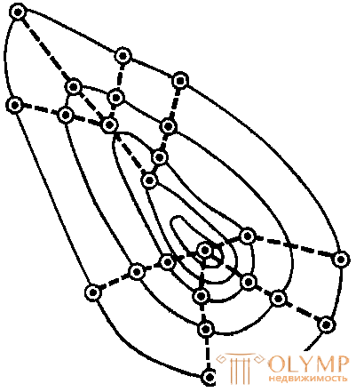 | e) 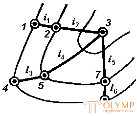 | |
Fig. 34. Schemes of digital terrain models
The digital terrain model in which the points are located arbitrarily within the homogeneous over the terrain, geology, hydrology of terrain plots without any particular system, but with a given density and density is called irregular.
Digital terrain model, which consists of points with known coordinates, placed at the tops of structural fractures (orographic) relief lines is called structural.
Structural DTMs are mainly used for rough terrain.
The points of structural digital elevation models can be located:
on the main bends of all structural lines (Fig. 34, d);
in places of change of slope curvature (fig. 34, e);
along the slopes along the lines of greatest steepness in places of characteristic fractures with an indication of the steepness and directions of the lines (Fig. 34, f).
4.3. Digital and electronic cards
Standard GOST 28441-99 set the following terms and definitions:
A digital map (CC) is a digital cartographic model, the content of which corresponds to the content of a map of a certain type and scale. The digital map is used for the manufacture of paper and electronic maps, is part of the cartographic database, is the topographic and geodetic basis of geographic information systems (GIS).
Electronic map (EC) is a digital cartographic model, visualized or prepared for visualization on the screen of the information display device in a special system of conventional symbols, the content of which corresponds to the content of the map of a certain type and scale.
Three-dimensional electronic terrain model - a visual and measurable terrain model, built on the screen of the information display device in the three-dimensional coordinate system in accordance with the specified observation conditions.
The electronic map is displayed on the screen using software tools (CAD, GIS).
The advantage of electronic cards is:
1) the possibility of their change as new data is received;
2) automatic search and issuance of necessary information;
3) image scaling;
4) layered data output on the screen, i.e. only the information that the user needs.
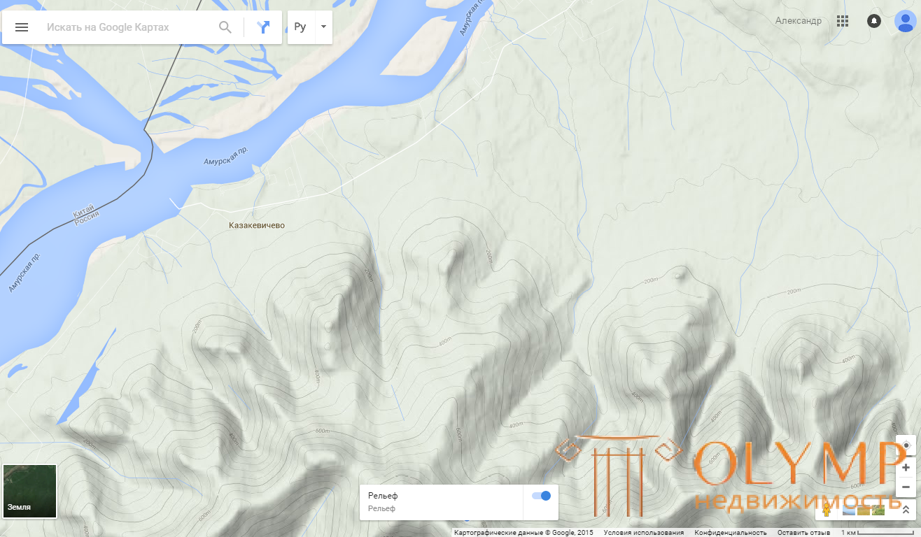
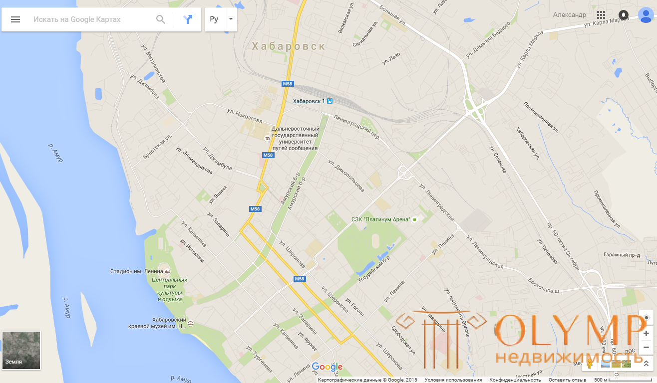
Fig. 41. Examples of electronic maps in the Internet service "Google Maps" with the display: a) relief; b) situations
For the presentation of electronic maps on the display screen, two basic methods are used: raster and vector.
The raster form of presentation is a method of representing digital cartographic information in the form of a matrix, the elements of which are the color codes of the cartographic image. Those. the image is divided into many discrete cells - raster elements.
The main drawback of the raster form is that the cell size is fixed, so undesirable effects occur when the image is resized. With a high magnification, the elements of the raster are no longer perceived by the eye as a uniform image. With a significant decrease in the part of the cells is not displayed, which leads to loss of information contained in the image, and its details become poorly distinguishable.
A vector form of presentation is a way of representing metric cartographic information as a sequence of vectors.
Vector images consist of mathematically defined lines (vectors), curves, and geometric shapes. The image is based on a vector frame. Such images are not distorted when scaled - they can be enlarged or reduced without visible loss of quality.
The vector data structure shows only the geometry of the map objects. To give it a map utility, the geometric data is associated with the corresponding attribute data stored in a separate file or in a database.
4.4. Questions for self-control
1. What is called a digital terrain model?
2. What data does DTM include?
3. With what software do they create a DMM?
4. Which DTM is called regular?
5. Which CMM is called irregular?
6. Which CMM is called structural?
7. What is called a digital card?
8. What is called an electronic card?
9. What are the advantages of electronic cards?
10. What methods are used to present electronic maps on the display screen?
Что бы оставить комментарий войдите
Комментарии (0)