The development of the planning structure of the city is subordinated to a whole complex of city - forming natural-climatic factors . The main ones are: relief, hydrographic conditions (reservoir configuration), climate (temperature, humidity, wind), planning restrictions (flooded or undermined areas, etc.).
In the process of town-forming a unique form of the city plan (planning structure) is being formed.

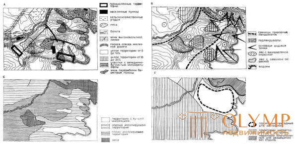
Fig. 69. Comprehensive urban development analysis of the territory for the placement of residential and recreational functions:
A - engineering-geological conditions and sanitary and hygienic state;
B - microclimatic assessment of the territory; B - architectural and landscape assessment of the territory; G - final assessment of the suitability of the territory for construction
Analytical work on the identification of the whole complex of city-forming factors is recorded in the following general plan drawings:
The scheme of the modern use of the territory (reference plan) with the display of information on the use of the territory (the existing residential and public buildings, its distribution by height and capital, industrial and communal facilities,
transport and engineering communications, green spaces, etc., fig. 70);
C heme constraints (layout constraints scheme) with display
cultural heritage areas (historical, architectural, archeological, nature reserves, etc.), zones with special conditions of use (mineral deposits, sanitary protection, water protection, noise protection zones, etc.), territories at risk of emergency situations with the threat of landslides, landslides, flooding, chemical and radiation contamination, explosive zones, etc., Fig. 71);
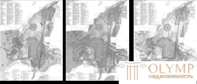
Scheme of a comprehensive assessment of the territory with the display of the results of the analysis of the integrated development of the territory (zones of different urban planning value, degree of suitability of territories for housing, industrial or recreational functions, Fig. 72)

Fig. 70. G. Kaltan. Scheme Figure 71. G. Kaltan. Scheme Figure 72. G. Kaltan. Scheme of the modern use of planning constraints of a comprehensive assessment of the territory
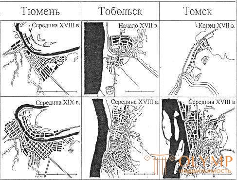
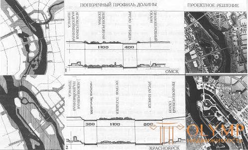
The influence of city-forming factors on the development of the urban plan can be clearly seen in the example of cities developing in unique and pronounced natural-climatic and landscape conditions. The planning structure of many Siberian cities was significantly influenced by hydrography and terrain relief (Fig. 73, 74).


(from the book of G. N. Tumanik "Center of a large city of Siberia. Regional features of formation and development", 2004)
Что бы оставить комментарий войдите
Комментарии (0)