Definition: planning structure - describes the urban organism in the unity of the relationship of its parts, elements.
Clearly planning structure is expressed in the placement of the main functional units and the configuration of transport links between different functional areas. Urban highways with adjacent territories are the most stable elements of the urban plan (framework).
When describing the planning organization of urban planning systems, the following groups of concepts are used:
Dot elements of the planning structure: cities, large separately located industrial and energy complexes, main transport hubs, functional or compositional centers (hubs, foci).
The center (node) is the point of concentration of any sign. In the city there are public service centers, transport areas, composite foci, etc.
Linear elements (planning axes) - river valleys, mountain gorges, seashores, highways, engineering structures, composite axes.
The planning axes are the concentration of a sign along a line (compositional or transport axes, functional or visual connections, etc.).
Zonal elements - vast territories with pronounced natural, economic and town-planning features, forests, water bodies, territories with varying degrees of urbanization or nature of functioning, zones of historic protected buildings, fields, sanitary protection zones, etc.
Also, when describing town-planning systems, the concept of a network is often used (engineering-transport, service and retail networks, networks of school and pre-school institutions, etc.).
Networks have the properties of point, linear and zonal elements of the planning structure. One of the most important characteristics of the network is its density.
In these concepts, both natural and anthropogenic elements of the territories are described and at different scale levels from the settlement system to the microdistrict.
Depending on the configuration of the city plan, there are 3 types of planning structures:
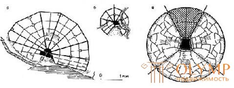
Compact (centric) structure - is characterized by the greatest polarization in the development of space and the most compact connections. This is the most common type of city in the pre-industrial era (Fig. 51, 52).

Fig. 51. a, b - plan of Kostroma and Soligalich, 1781, c - theoretical model of the new city, L. Kibl, 1961
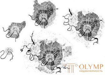
Fig. 52. Center Development of the Planning Structure of Moscow
Advantages of a compact structure
• compactness of the plan;
• good availability of the center;
• The least negative impact on the natural environment.
However, the advantages of this scheme can be fully realized only with a limited settlement size. With an increase in these dimensions, the advantages quickly turn into their opposite.
Disadvantages of a compact structure
• removal from the natural environment of the central regions;
• removal of peripheral areas from the center • traffic congestion in the city center.
To neutralize the negative consequences of excessive territorial development of centric structures, the construction of satellite cities (Fig. 53) and the dispersion (discrete) development of the city (Fig. 54, 55) are proposed.
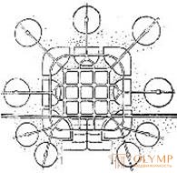
Fig. 53. R. Envin, city with satellites, 1922

Fig. 54. E. Saarinen, the scheme of "organic decentralization" of the city, 1943

Fig. 55. E. Saarinen, proposals for decentralization:
a - Helsinki; b - Tallinn; in - Stockholm
The linear planning structure is formed along the main transport route or is dictated by specific natural conditions (relief conditions, hydrography). Linear structures are less compact and compacted with respect to the main transport route that forms them (Fig. 56-60).
An elementary prototype of a linear structure is a small settlement, the basis of which is a group of houses built along a road or coast.
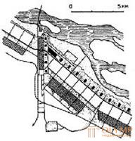 Fig. 56. A.I. Kuznetsov and others.
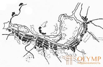
Competition project “New Pic. 57. The scheme of the master plan of Volgograd,
Charjui ", 1930 1945
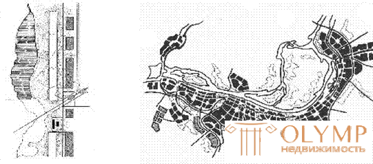
Fig. 58. N.A. Milyutin.
Functional flow chart
development of Magnitogorsk, 1930 59. Scheme of the master plan of Volgograd, 1984.

Fig. 60. Le Corbusier and Jeanneret, project of Zlin, Czechoslovakia, 1935
• availability of a transport artery (fig. 61), reduction of time spent on pedestrian movement to stops;
Fig. 61 
• comparative proximity to the natural environment (Fig. 62), is preserved in linear structures of any size;
Fig. 62 
• dismemberment of natural landscapes, breakage of environmental links (Fig. 63);
Fig. 63 
• extremely uneven distance from the center (Fig. 64), increasing with the territorial development of the city;
Fig. 64 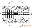
• Territorial development leads to inefficient operation of the transport system (Fig. 65), as the city grows, transport communications stretch and time travel costs increase dramatically.
Fig. 65 
Overcoming the shortcomings of the linear structure is possible with the addition of the main axis of the city’s development with transverse axes. In this case, the transformation of the linear planning structure in the network.
The lattice (network) structure reflects a relatively uniform development of the territory, is a combination of the main centers and axes, is formed on the basis of the synthesis of centric and linear structures (Fig. 66).
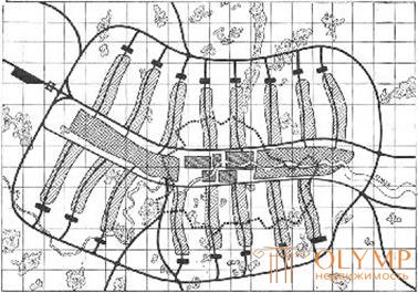
Fig. 66. Proposal for the development of London, 1947, group MARS In the process of a long evolution of the urban planning system, all three forms of the planning structure can mutually complement each other.
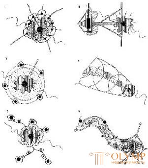
Fig. 67. Variants of the territorial development of Paris, materials of the competition.
1 - concentric growth; 2 - the formation of satellite cities; 3 - directional development,
4 - the formation of "parallel" Paris; 5 - dinapolis system; 6 - linear development
A significant number of factors affect the development of a city. One of the main tasks of urban planning theory and practice is their study and maximum consideration in the design. It is customary to distinguish town-forming and city-forming factors.
As town-forming factors (functions) can be: a convenient position in the settlement system, location at the intersection of transport routes, development of mineral deposits, location of large industrial enterprises, research complexes, resorts.
The complex of city-forming factors (functions) changes in the process of the evolution of the city. For example, Novosibirsk emerged as the most important transportation hub at the intersection of the waterway and the railway, later it was transformed into a large multi-profile city (industrial and administrative, scientific and educational, trade and distribution center of a vast region).
In the process of city formation, a unique functional structure of the city is formed (the structure of employment in the sectors of the economy, Fig. 68).

Fig. 68. The structure of employment of the population of the city
Definition: city-forming enterprises (industries) - enterprises, groups of enterprises, industries or activities that are leading (dominant) in the city's economy, for example: a complex of recreational facilities and hotels in a resort town, a research institute system in a scientific town, a large plant (enterprise) in the industrial city, the system of administrative institutions in the capital center, etc.
City-forming population - population occupied in city-forming enterprises (in city-forming industries) of a city.
At the stage of pre-project studies (feasibility study), an analysis of town-forming factors is carried out, on the basis of which it is possible to draw a conclusion about the city’s development prospects - general economic potential, dynamics of changes in the functional structure, employment structure, demographic structure and prospective population, etc. This allows us to adequately formulate a general strategy for the development of a settlement (a strategic plan for the development of a municipality), which is the basis for the development of town planning documentation.
Further, the whole complex of city-forming factors is analyzed, which will influence the development of the urban plan (Fig. 69).
The development of the planning structure of the city is subordinated to a whole complex of city - forming factors : topography, hydrography, climate, the presence of planning restrictions (water protection or sanitary protection zones), tracing railways and highways, and the placement of industrial facilities and engineering structures.
In the process of town-forming a unique form of the city plan (planning structure) is being formed.
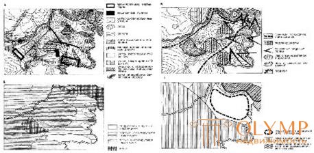
Fig. 69. Comprehensive urban development analysis of the territory for the placement of residential and recreational functions:
And - engineering-geological conditions and sanitary and hygienic state,
B - microclimatic assessment of the territory; B - architectural and landscape assessment of the territory; G - final assessment of the suitability of the territory for construction
Analytical work on the identification of the whole complex of city-forming factors is recorded in the following general plan drawings:
Scheme of the modern use of the territory (reference plan) with the display of information on the use of the territory (the existing residential and public buildings, its distribution by heights and capital, industrial and communal facilities, transport and engineering communications, green spaces, etc., Fig. 70);
C hema restrictions (layout planning restrictions) with the display of territories of cultural heritage (monuments of history, architecture, archeology, reserves, etc.), zones with special conditions of use (areas of mineral deposits, sanitary protection, water protection, noise protection zones, etc.) , areas at risk of emergencies (areas with the threat of landslides, landslides, flooding, chemical and radiation contamination, hazardous areas, etc., Fig. 71);
Scheme of a comprehensive assessment of the territory with the display of the results of the analysis of the integrated development of the territory (zones of different urban planning value, degree of suitability of territories for housing, industrial or recreational functions, Fig. 72)
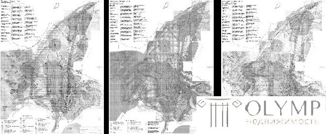
Fig. 70. G. Kaltan. Scheme Figure 71. G. Kaltan. Scheme Figure 72. G. Kaltan. Scheme of the modern use of planning constraints of a comprehensive assessment of the territory
The influence of town-forming factors on the development of the urban plan can be clearly seen in the example of cities developing in unique and pronounced natural-climatic and landscape conditions. The planning structure of many Siberian cities was significantly influenced by hydrography and terrain relief (Fig. 73, 74).
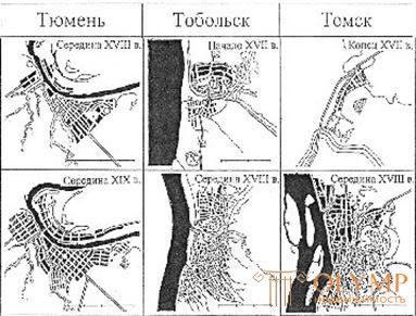
Fig. 73. The influence of natural landscape conditions on the formation of urban plan
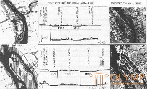
Fig. 74. Consideration of hydrographic and landscape conditions in urban planning (from the book by G. N. Tumanik "Center of a large city of Siberia. Regional features of formation and development", 2004)
Two fundamental approaches to the natural context in urban planning
Subordination | Ignore |
Stockholm
Austria
Village Ecolonia, Netherlands |
Project planning about. Manhattan, 1811 (New York)
Paris, reconstruction project, 1925, Le Corbusier
Moscow. Reconstruction project, QUESTIONING Team, 1932 |
However, complete obedience or complete disregard for natural conditions is hardly possible, rather, one should speak of striving for one thing or another.
Что бы оставить комментарий войдите
Комментарии (0)