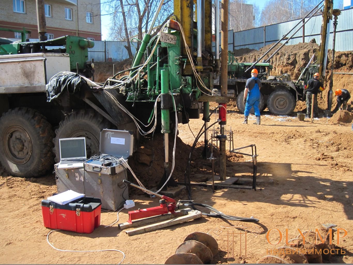
For engineering and geological surveys conducted during the reconstruction of structures, the following features are characteristic:
constraints on the territories where engineering and geological workings are necessary;
sometimes the presence of sufficiently rich material of the previous surveys carried out in the design of reconstructed structures;
the need to inspect structures, including the foundations of structures to be reconstructed;
determination of the possibility of increasing the load on the base without strengthening the existing foundations;
assessment of the possible sediment of the existing foundations to which the project is adjacent to new structures;
the possibility of excerpts of the pit near the loaded existing foundations;
assessment of soil compaction at the base of existing foundations.
Sometimes it is necessary to establish the possibility of tunneling around existing structures, changing hydrogeological conditions, the effects of dynamic effects during construction on the foundations of an existing structure, etc. In some cases, these complex issues must be solved according to a special program compiled by a geological engineer and a civil engineer.
Proper assessment of soil compaction at the base of existing structures in many cases allows significantly increasing the load on the foundations already loaded by calculation.
Engineering and geological surveys are an integral part of work related to engineering surveys in the survey of buildings and structures to be reconstructed. Engineering surveys are carried out in accordance with the SNiP "Engineering Surveys for Construction" and provide, in addition to performing various studies on the condition of soils of foundations and foundations, of conducting geodetic surveys of the position of columns and bases of buildings, as well as large-sized foundations in order to establish their uneven sediments (relative displacements, rolls , deflections, etc.). The data obtained allow us to judge not only the state of the super-foundation structures (bearing in mind the limiting values of deformation according to SNiP 2.02.01-83), but also the presence of such places in the area
The task of engineering geological surveys is:
- drawing up a general geological section of the base along the depth of the compressible sequence;
- identification of the hydrogeological regime and chemical composition of groundwater; determination of physical and mechanical properties of soils at the level of the base of the foundations and below it;
- determination of compliance of new research materials with archival, if any;
- determination of the possibility of using soils as a foundation for the building being reconstructed with increasing loads without strengthening them or strengthening the foundations.
The scope of work on engineering geological surveys at the site of the reconstructed building includes the following types of work:
- selection of technical documentation, the study of engineering-geological and hydrogeological conditions for archival materials;
- the appointment of sites for the study of ground bases by sounding or drilling, as well as determining the level of groundwater;
- the appointment of the necessary depths of probing, drilling, pitting, sampling of soil undisturbed structure and groundwater samples for subsequent laboratory studies;
- the study of base soils by sounding or drilling;
- development of pits, including near the foundations, a detailed survey of the soils of the foundations and structures of the foundations in them with the selection of monoliths of the soil of the undisturbed structure;
- determination of strength and deformation properties of base soils in natural conditions;
- laboratory studies of the physical and mechanical properties of the soil and chemical analysis of groundwater to determine the degree of their aggressiveness;
- performing verification calculations of the bases, drawing up a conclusion on the engineering-geological and hydrogeological conditions of the site.
It is known that in the territories of residential microdistricts, as well as industrial enterprises, there is a significant change in hydrogeological conditions due to the draining effect of utilities, leaks from pipelines, technological features of production, etc. The presence of industrial ponds-settlers, treatment facilities, new reservoirs, passing near canals for irrigation of agricultural land, frequent irrigation of sown areas has a great influence on the level of groundwater. Usually in built-up areas, the level of groundwater rises significantly. The speed of its rise can be significant and reach 0.3-1.5 m / year. Considering the fact that soaking soils can fundamentally transform the strength and deformation properties of base soils (for example, subsidence, saline or swelling), it is necessary at the survey stage for a project to reconstruct a residential and industrial complex to fulfill the forecast of flooding of the grounds . It is also advisable to identify the possibility of changing the chemical composition of groundwater.
Prior to the commencement of excavation work, permission should be obtained from the relevant organizations in the prescribed manner for drilling holes, drilling wells, sounding, and installing geodetic marks. At existing enterprises, these works must be coordinated with the technical department, the main power engineer, the chief electrician, communication services, etc. When performing underground work, you should observe the safety regulations in force in the survey organization, as well as the safety regulations of the enterprise where the specified work is performed. After the end of drilling and drilling, the workings should be thoroughly buried with layer-by-layer tamping.
Thus, during the reconstruction of buildings, enterprises and cities, it is necessary to produce additional non-standard and quite complex surveys under a special program.
Что бы оставить комментарий войдите
Комментарии (0)